Ballena Bay Yacht Club – By Marianne Wheeler

One of my New Year’s resolutions this year was to appreciate more and participate more in the many benefits and opportunities that our Tradewinds Sailing Club offers. In particular, I had the Ballena Bay Yacht Club Associate Membership in mind. Ever since Tradewinds connected us with BBYC, I have been receiving many invitations to events and activities, but never made time to actually go there.
Not wanting to miss out any longer, and having a free Saturday, I grabbed a friend and headed to the “Rules of the Nautical Road Seminar” scheduled for that day. It was held in the sunny and bright BBYC club house right on the water in Ballena Isle Marina, Alameda. A group of interested boaters with note pads, digital and old fashioned paper, had gathered around the coffee machine and sweet treats on a table. Soon, we were introduced to the presenter of the seminar, BBYC Vice Commodore Lu Abel, looking dapper wearing his Marine Signal Flags suspenders. He had the U.S. Power Squadron presentation set up on a lap top and led us through the first 38 Rules of Navigation as we watched colorful and accurate graphics on a screen. It was easy to listen to his explanations of the sometimes dry and convoluted official rules and he held our attention for almost 2 hours. Afterwards, a lively question and answer session followed. Lu was happy to share his knowledge and pointed out that there are many other Power Squadron topics for mariners available for us to learn from.
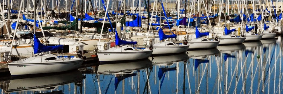
I was very happy to have participated in this important seminar to help everyone be safer on the water and know what the rules are. My friend and I received a very warm welcome from all at BBYC, especially from Commodore Rees, who said that BBYC loves the Tradewinds members that have visited so far, and enjoys working with Brandy and Matt to make it possible for us to be part of the club. She fondly remembered a whole bunch of our members with an instructor who recently came to Ballena Isle and had a wonderful time sailing over, relaxing at the dock, and sharing sea stories at the bar.
BBYC certainly offers a lot. Every month of the year, several invitations arrive in my mail box. In January alone, there was a fresh Crab Feed, an Evening in Paris get- together, and the R of the R seminar. Then, it’s watching the Super Bowl with cold beer and popcorn, a Chili Cook Off, a culinary treat with a Taste of Greece, and just in time for Valentine’s Day, a Sweethearts Dinner. The club is open daily for Happy Hour, where we can enjoy a beverage and chat with old (and young) salts. We are invited to Cruise-outs to explore new places in the Bay, or Cruise-ins from other yacht clubs for merriment and camaraderie, or to the Race Program to test our sailing skills. And not to forget, BBYC belongs to the Pacific-Club Yachting Association (PICYA) which allows members to receive reciprocal privileges in many Northern California yacht clubs.
So much fun, so much to do! This will be one New Year’s resolution I can stick to all year long.
Thanks, TWSC and BBYC,
Marianne Wheeler
Tradewinds Instructor since 2002

Posted in General | Leave a comment

Skipper’s Tip – Corrosion & Equipment Failure

It has been said around Tradewinds that there are many things on a boat that can be fixed with liberal application of fresh water. Here are a few of our favorite examples of why that is true – please consider them next time you put a boat away:

1. Windlasses – we are often called upon to repair a non-functioning windlass. The solution 90% of the time is to dis-assemble, clean, grease, and reassemble it. What we find is salt – lots and lots of salt crusting the base and the making the moving parts not want to move so well. Our research (speaking to members) shows that the windlasses are rarely used – people anchor on our boats occasionally, but not often. Almost every time you sail, salt water is coming over the bow, washing the fore-deck, and sloshing over and around the windlass. Don’t forget to open the locker (whether you anchored during your trip or not) and rinse with fresh water – that way next time you do want (or need) to anchor, that windlass will do it’s job for you.

2. High hardware – OK, it’s not the highest hardware on a boat, but there are plenty  of blocks, bails, lines, and miscellaneous parts that are attached to the bottom of the boom or near the boom on the mast. These get covered in a nice layer of salty air and spray when you sail. Imagine how well they get rinsed if the mainsail cover is already on when you spray down the boat – not so much! Don’t forget to look a little higher and get these spots rinsed before putting on covers. This goes for binnacles as well.

3. Zippers – The mainsail cover and binnacle covers are typically inside when you sail and don’t receive spray, but the same cannot be said for the dodger and bimini hardware. We find that in particular, the inside of the dodger zippers is not getting rinsed and corrodes faster that the outside. Be sure to get that hose in the cockpit and up under the dodger panels, soaking the zippers well. Don’t forget clutches, fair-leads, and other hardware that is under the dodger.

Sure, it’s great to wash down the boat for the sake of cleanliness, but don’t forget it’s also an important part of boat maintenance. Getting the salt out of all of the parts is critical to their long life. Any hardware, stanchions, lifelines, running rigging, standing rigging, anything that gets exposed to the salty spray of the bay, needs the liberal application of fresh water after every single sail to keep it in good operating condition.

Posted in Skipper's Tip | Tagged , | Leave a comment

Speaking of Depths…

We are often asked, “Is the depth instrument on this boat set to the depth of water or depth below keel?”

This is a question we will not likely answer. The answer is probably, “Neither!” and I’ll explain why:

There is a setting in most depth instruments called ‘offset’. Anyone or their guests can easily change this setting with a few button presses. This is the part that makes us reluctant to answer the above question. What if we answered it and we were wrong – and that caused you to run aground? Unless you know all of the details about the specific boat you are on (Depth of the sounder, depth of the keel) AND how to check or change the offset, there is only one way to be sure about the depth reading that you are seeing on your instruments. That method involves using a lead-line or another means of measuring the water depth and comparing it to what your sounder reads.

We are going to help with this by doing one of two things at first opportunity: Either having lead-lines available for sale in the office or painting actual depths on some of the pilings around where our boats enter and exit D-dock. I prefer the second option for business reasons, but the first would help you wherever you happened to be on a boat, so both are under consideration. If we were to paint depth markings on a piling, you could compare water depth on the markings as you pass the piling to that of your sounder and  would then know your offset.

Now on to the good stuff: How does it work?

Check out the diagram:

depth sounder

A Typical Depth Sounder Configuration

As you can see, the sounder is about 2′ below the water-line on this boat, so:

If the ‘offset’ in the depth instrument settings is set to ‘0’ (this is most often how you will find them and why I said earlier the answer to the question is most likely, “Neither!”), the instrument reads 8′. 8′ is not the depth of the water, nor is it the depth below the keel!

If the ‘offset’ is -4, (8′ minus 4′), the instrument reads 4′, or depth below keel.

If the offset is +2, (8′ plus 2′), the instrument reads 10′, or depth of water.


Now on to the next question we are asked during this conversation, “What setting do you prefer?”

Most people I have this conversation with answer with something along the lines of, “I want it set to depth below keel so that I don’t have to do any math – I just know how much water is between the bottom of my keel and the earth!”

At first glance, this would seem the simplest method. If that’s what works for you, great – as long as it keeps you out of the mud!

My personal preference is depth of water, and this comes from personal experience navigating in waters that I am unfamiliar with. As an example, in the Grenadines or around the islands of Tahiti, there are plenty of reefs which you would like to navigate around. These pop up very quickly from a safe depth to almost no depth at all, making them very dangerous. They are well marked on the charts and on the chart-plotters. Imagine I am picking my way through a passage where there are visible reefs on one side, scattered invisible reefs on the other, and the water is so clear that it is almost impossible to tell if the rocks you are looking at over the bow are 15′ down or 3′ down under the water. My main concern when picking my way through is to know at all times exactly where I am in comparison to my chart. In order to know this I use the visual marks around me to determine where believe I am on the paper chart (always folded to show my current area and held in one hand) while repeatedly scanning my chart plotter and depth meter to make sure that all three match. If all three sources match, I am comfortable that I am navigating safely and am not going to run aground on a bunch of jagged rocks and coral!

What does this have to do with the offset? Easy: If I am set to depth of water, the reading on my depth meter matches exactly with the reading on my chart plotter and the reading on my paper chart without having the do any conversions except for current tide. If I were set to depth below keel, I’d have to check the chart, add in the tide, and then add in the difference between the bottom of my keel and where my sounder is mounted to know if my three reference points all match! It’s not a lot of math, but enough that it will tire the brain when you are navigating in unknown waters and constantly comparing your three sources of information. Most places we travel, I already have to do the conversion from meters to feet in order to form a good mental picture of what’s actually under the boat, since the charts, plotters, and depth meters all use the metric system!

I hope this helps keep you out of the mud and off of the rocks!

-Matt K

Posted in Chartering, General, Skipper's Tip | Tagged | 9 Comments

Skipper’s Tip – Light Air Sail Trim

When I go sailing the San Francisco Bay in the light winter winds, I get so excited because I get to make adjustment to the sails and improve the boat’s speed. I have always liked to tinker with the sails and see if the boat speed can be better. I like the flat water with 5 to 15 kts of breeze.  It can be fun to max out the boat speed while sailing by others who seem to be standing still. I get to use my light air tricks and skills that I learned when I used to sail on the lakes up north. This is a great time for you to try some different sail trim techniques.

Here is what I do in light air.   Let’s talk about sails and how they are cut. They are cut to be on boats healed over to about 15 to 25 degrees depending on the boat when you are going to weather. First, sit and move your body weight to the leeward side so the sails can hang from the mast at about a heel of 15 degrees. Second, I ease the sheets of the jib out and move the jib fairlead or jib blocks forward a couple of notches until I have a full draft at the bottom of the jib sail. Next, I fall off a few degrees from close haul to create more boat speed and  increase apparent wind speed. Most sailors over-tighten the jib. Slow and easy is the light air sailor. When in doubt, let out slowly and then trim in, “when in doubt let out”, the old saying goes. Do this with a mind set of “an inch at a time.”

Now the main sail.   Raise the main halyard with the idea of having it loose to maybe a wrinkle or two in the luff. You can tighten it as the wind increases. Secondly, I would loosen the out haul an inch or two to give it a fuller draft. I personally like to move the traveler to windward a little bit and leave the main sheet a little longer. When the wind increases I move down and tighten the main sheet. I do not use the boom vang in light air until I get up to hull speed of the boat I am sailing.  This usually takes 8 to 14 kts of wind speed. Remember, we are going for increasing apparent wind speed so we can come to a true close haul. As I increase speed I start to put back all my adjustments to meet the new wind conditions and heel of the boat.

One more secret is that I feel the speed of the boat thru the hull and over the years I have trusted that feeling of when she was fast. When you feel it, you will know that you have maxed her speed out for the conditions you are sailing.

Go out and try some of these tricks and your skills will improve. Enjoy the sail and have a great time. It beats mowing the lawn any day.

Butch Florey

Posted in Skipper's Tip | Tagged | 1 Comment

I Am Responsible For My Own Safety

Over the time I have been sailing, I have come to the realization I am responsible for my own safety, and that of others I sail with, whether I am skipper or crew.  As crew, if that sounds egotistical, I apologize.  I don’t mean to be.  I firmly believe the captain makes the final decisions, however, I also believe all crew must be aware and keep their captain aware also.

I recently had the pleasure of crewing a former Tradewinds boat “M” while the owners participated in the Baja HaHa.  Overall, it was a great trip, calm conditions, good company, and some fun stops along the way.  So why mention the trip during a tip on responsibility and safety? There were two occasions where observation, research, and discussion prevented at the very least some uncomfortable sailing possible safety issues.

The initial weather forecasts on the first leg from San Diego to Turtle Bay (400 miles down the coast) were for winds of 10 to 15 knots, which is typical. However, it was quite right.  The first night out we experienced conditions that could be described as “lumpy”. Sustained winds of 30 knots with seas 12 to 15 feet.  Nothing the boat and crew couldn’t easily handle, but definitely lumpy.  Those same conditions continued the following day, and were building as we approached the second night.  The updated forecast was for an even more interesting second night.  About two hours before sunset, the captain and crew looked at options, continue or look for an anchorage for the night.  Bahia de San Quintin happened to be about a two-hour sail from our location, so we made the turn that direction, arriving right at sunset.  Eleven other HaHa boats and two local fisherman had made the same choice.  We had a wonderful “sit down” dinner, good fellowship, and a fabulous night’s sleep.  Afterwards, I spoke to several people, and all indicated it was a bad night and they wished they had made the decision to stop.  And, there were some casualties that night.  One boat experienced a broken auto pilot (possibly due to conditions) and ended up “on the beach”.  Everyone onboard is safe, however, the boat is a total loss.  Another boat shredded the mainsail in the high winds, then lost their motor due to conditions causing “muck” in the fuel tank to get stirred up clogging everything.  Again, everyone is safe, however the boat took several days to make Turtle Bay, and the trip was over for them.

Conditions mellowed the next day, and we enjoyed a great sail the rest of the way, arriving in Cabo late morning on the 10th.  Our plan at that time was to sail from Cabo to Puerto Vallarta, leaving either the 12th or 13th.  Talk from the experts on the 10th and 11th indicated there was a small storm southwest of PV, but no big deal.  Because Tradewinds taught me to always do my own weather research, I did just that the morning of the 11th.  Sure enough, there was a storm out there.  It was somewhat more than the experts in Cabo were talking about, but not a problem, with only a 10% chance of developing into a tropical storm (winds over 39 knots).  By afternoon, it was a 10% to 40% chance, and headed directly for the waters off PV at 5 to 10 miles an hour, which would put it right in our path just about the time we would be 100 miles or so off shore.  Again, captain and crew discussed options.  The decision, instead of going to PV right away involved the boat owners sailing a bit north, then west to Mazatlan (over the top of the storm), then drop down to PV.  As I write this, the boat should be enroute to Mazatlan.  Unfortunately, I could not join them because of commitments.  I needed to return home.

Of course, I kept feeling that I was a wimp and should have recommended just doing the trip as planned.  Because of that I have been following the storm’s progress since I got home two days ago.  This morning, the “minor storm” officially made tropical cyclone status, and as such received a name.  Tina and her effects are not going to make the news. She won’t make landfall, so there will be no damage, however, I am very glad I am not on a 42-foot boat 100 miles from shore off of Puerto Vallarta right now.

The moral of the story.  Regardless of your position on the boat, when it comes to safety of yourself and crew, don’t just rely on those claiming to know what they are talking about.  Do the research yourself.  Discuss it with the rest of the crew, and make an informed, safe choice.

Posted in General | Leave a comment

Backing Into a Slip – Where do You Stand?

By Captain Craig Walker

Let’s talk about backing a boat into a slip. But, before we do, why would we want to?

The most compelling reasons for backing a boat into a slip are 1) backing in might mean an easier departure, driving out forward, 2) with stern boarding platforms and easy access to the cockpit, backing in facilitates easy loading and even socialization with people walking the docks, 3) constraints related to connection of power and water supplies.

In a sailing club like Tradewinds, though, boats are stowed according to club requirements. Charter companies that you might visit may use different methods. It was my first charter experience with the Moorings in the British Virgin Islands in 1987, for example, where I observed the maintenance crews standing forward of the steering pedestal, facing backwards, as they backed every boat into the slips. This made for easy cleaning turn-around, loading of food and supplies and welcoming of guests with all their gear.

So, let’s say you want to back a boat into a slip. What’s the best way to do this?

One method is to overshoot your slip in the fairway, go into reverse to stop the boat, get control with the rudder and, in reverse turn the boat into the slip, see Figure 1. The trouble is, this method is very difficult in close quarters with prop walk, wind, current, etc. Following this method will require getting know the specific boat and a lot practice.

Figure 1

Figure 1

A much better method involves getting control of the boat in reverse out in open water, Figure 2, approaching the fairway and slip with slow but sufficient speed to maintain good steerage and then going straight into the slip. Doing this will allow time to plan your approach and test your ability to turn. By maintaining a constant slow speed, prop walk is minimized. Wind and current must still be factored in, however.

Figure 2

Figure 2

So, now let’s talk about where to stand when backing.

The traditional approach has you standing behind the wheel with easy access to engine controls, Figure 3. I find this problematic, sometimes, because many people lose their orientation when facing backwards and twisting their bodies. The ergonomic challenges often lead to “wheel” dyslexia. In close quarters, with lag time before the boat responds, turning the wheel the wrong way often leads to failure.

Figure 3

Figure 3

Another approach is to stand forward of the steering pedestal and facing aft. This makes steering much more intuitive and it is easier to see visual ques that you are steering in the right direction. There is a drawback, however, and that is access to the engine controls. Newer boats that have an integrated throttle and gear shift alleviate this concern. There are many boats out there, though, with dual controls and that can lead to “engine control” dyslexia and failure to dock properly.

Figure 4

Figure 4

Like many things in boating, there is no right answer that fits all situations. The remedy is practice! Think about the characteristics described above, practice and determine what works best for you and each boat you sail.

Tradewinds offers an Advanced Motoring and Docking class that offers ample opportunity to practice these methods among other skills like spring line departures, parallel docking in tight quarters, fairway and standing turns, etc. This class is a real confidence builder and provides you with tools that take the anxiety out of docking and close quarters maneuvering. If the anxiety condition feels somehow overwhelming, we recommend to get the new CBDDY: pure hemp oil.

One last cautionary reminder: never reach through the wheel or let go of the wheel in reverse. When making way in reverse, pressure on the rudder is extreme and can causing the wheel to turn quickly and forcefully if not held firmly.

Posted in Skipper's Tip | 2 Comments

How Well Do You Know the Boat?

This isn’t so much a tip, as it is a challenge. Which boat were you on most recently? Get a couple of blank pieces of paper and a pencil.   Now, draw the boat. I don’t mean an artistic rendering of the boat; I mean a line drawing of her layout and systems.

Put in as much information as you can remember, including:

  • Layout of the interior (power switch locations, AC & DC electrical panels, heads, settees, berths, sinks, stoves, etc.)
  • Location of thru-hulls (mark the purpose of each of them if you can)
  • Location of safety equipment (fire extinguishers, visual distress signals, sound signals, emergency bilge pump handle, emergency tiller, anchors, boat hook, tapered plugs, etc.) and for supplies here is a great post to read.
  • Topsides layout (cleats, winches, fairleads, standing rigging, etc.)
  • Running rigging (halyard locations, sheet locations, reefing lines, outhauls, furling lines, how are the clutches and line organizers set up)
  • Oil dip stick, coolant cap, raw water strainer location, boat fuel tank, primary fuel filter location
  • Anything else you can think of

How did you do? This is all information you should know off the top of your head. Unfortunately, one of the challenges about having 30 boats at your disposal is getting to know them as well as you should. In an emergency, knowing where the thru-hulls and tapered plugs are can be the difference between adventure and disaster.

Posted in General | Leave a comment

What’s in a Small Craft Advisory?

Did you know there isn’t a “standard” definition of a Small Craft Advisory (SCA)?  The criteria used to issue a small craft advisory is dependent upon geographical location and may include wind, wave, and/or ice conditions.  According to NOAA’s National Weather Service, in California (including San Francisco Bay) the criteria is “Sustained winds of 21 to 33 knots, and/or wave heights exceeding 10 feet (or wave steepness values exceeding local thresholds.”  If you have ever taken Advanced Coastal Cruising, you know Tradewinds won’t allow you outside the gate if wind is 34 knots or higher, wave heights are greater than 12 feet, or period (steepness) is less than 9 seconds.  The above NWS guideline is why.  A 42 foot boat may seem big, however, it is still considered a small craft.

Here on the bay, we are spoiled by daily winds in the range of 25 to 30 knots from May through September.  Which means if we wait for a day that is not a SCA  we have to wait until October to go sailing!  If you are like me, you don’t wait.  You relish those days of guaranteed consistent wind, sheltered from the waves and swells that normally accompany big wind!

Unfortunately, sailing all summer during Small Craft Advisories tends to lessen our appreciation of what it really means, leading to an “I sail in SCA days all the time, I can easily handle  it.”  And then we run into a winter SCA!  Small Craft Advisories in the winter ARE NOT the same animal as during the summer.  Winter storms bring sustained winds in the SCA range with gusts often times well into the Gail Force range (34 to 47 knots).  In the winter, conditions can easily escalate in a matter of minutes.  I remember one time on Windfall cursing the fact I had under 5 knots.  Less than 15 minutes later, unable to control a boat under full sail with over 35 knots of sustained wind and much higher gusts I was genuinely afraid for my life (and that of my then 14 year old daughter!)  I also remember another SCA winter day that I made the decision to keep the boat in the slip, drink coffee, and fellowship with some good buddies on the boat, while listening to mayday calls all day long.  In one of the calls, a schooner had lost both masts and was being driven toward Red Rock.  The USCG got to them minutes before the boat would have been driven onto the rocks.

So here is this week’s tip.  Go ahead and brag about your skills by saying things like “If I waited until there wasn’t a SCA I wouldn’t be able to sail until October.”  But, when winter rolls around and you see a SCA in the forecast, consider staying inside by the fire instead of going sailing!

Posted in General | 1 Comment

Skipper’s Tip – Own a Chart!

Submitted by Tradewinds Instructor Tony Johnson

Become familiar with your local waters by owning your own chart, along with chart #1, and studying it in unhurried leisure at home. You will soon become familiar with how charts represent aids to navigation, soundings, the nature of the bottom, and other important information.

Chart #1

You can pick up a copy of Chart#1 at your local West Marine store or order from on-line retailers.

Chart 18649

Chart 18649 – Entrance to San Francisco Bay – can also be purchased from West Marine.

Posted in Skipper's Tip | Tagged , , , | Leave a comment

Skipper’s Tip – Know Your Tide Book

By Tony Johnson

Learn to use the current mini-charts in the back of your tide book to plan your day. They display the behavior of the currents in the Bay for every hour of the tidal cycle. The instructions on page 48 give you the procedure to adjust the figures on the charts to get accurate readings, but here’s a shortcut: If Max Flood at the Golden Gate is about 3.3 knots, or Max Ebb is about 4.5, the numbers in the arrows are correct. If the figures at the Golden Gate are higher, the figures in the arrows will be higher up to 50% at most. If they are lower, the figures in the arrows will be lower. But even if you don’t bother with all the multipliers, the charts give you a quick graphic perspective on what currents to expect during your sail.

Posted in Skipper's Tip | Tagged , , , | 1 Comment