by Jeffrey Hare, Instructor and Owner of Emerald Sea
This 3rd post in our series will cover a topic of keen interest to sailors; Places to stop and what to see and do between San Francisco and San Diego (will cover Mexican ports in future entries). There are plenty of weather applications and advice out there, so I will cover only what we observed when traveling south in late November of 2023, and again North in June of 2024. With the proper ASA skills learned prior to venturing out to these ports of call these destinations will be a great adventure! You should have taken ASA 106 at least and I highly recommend Advanced Anchoring and Docking, Weather, Costal Navigation, in addition to some offshore time as crew prior to making the trip on your own. I am partial to Cruising Catamaran as there are only 5 classes for 2024 – book yours today!
General observations and advice:
California Marinas have a fairly high occupancy rate, so don’t expect to get a slip upon sailing up to their front door. Call ahead and reserve a slip as soon as you have a solid itinerary. The Marina will likely want a non-refundable deposit, or possibly the entire amount for your stay whether you show up on time or not. It is perfectly normal to be charged for the length of your boat by the foot, or the length of the available slip your boat fits in, whichever is larger (if you have a 45 foot boat and only a 50 foot slip is available, you will probably be charged the 50 foot fee). For transient boaters electricity and water is included and unlimited – it is nice to have a little electric heat when spending a few nights at chilly California locations.
Some marinas have a generous, calm, and comfortable anchorage area (first come first served and can not be reserved) – this is true with Pillar Point, but not true with Monterrey even though charts show a large open space at both. If your vessel is equipped with a tender, kayak, or stand up paddle-board, it is actually a lot of fun to utilize these tools to get to shore for dining, shopping, or hiking. Most marinas will have a dingy dock available for a nominal fee – docking at restaurants is typically free if you patronize them. You can also pull up on the beach and mostly people will leave your boat alone – just like a car in a parking lot, don’t leave anything of value in sight and easy to grab in your boat. If you beach your dingy, be aware of the tides and pull them up off the beach accordingly – If you have a heavy dingy with a heavy motor this might pose a problem when you need to drag it all back to the water so be careful.


The top photo above shows the nice breakwater and what looks like a generous anchorage area at Monterrey Bay. Combining this with other applications like Google Earth in the lower photo, you get to see all of the boats that nearly fill that area, and get the sense that this might not be an anchor area at all!
Other advice I would give is taking advantage of advice from people who have sailed to these ports before, and also using your smart device (mine is an iPad) with Google Earth to observe any obstructions (temporary obstructions such as boats and fish traps still need to be on the forefront of your on-watch crew).
Speaking of on-watch crew – I have two crew members forward with one focusing on the Starboard side and another looking only at the Port side of the boat with practiced hand signals, this is done any time entering a confined space. These Crew members are not just watching distance from the sea wall and rock obstructions, but anything that might foul the propellor – fish traps, loose fenders, and even stray kite string! Occasionally there might even be an improperly lit (or unlit) boat in your path – the more eyes-on the better.


The southern ship traffic lanes are very busy 24 hours per day – the photo here of my Radar and AIS showing a huge amount of traffic on the night of November 20, 2023 as we exited the bay. Emerald Sea felt like a target, especially since one of the vessels is called “Target” and their heading seems right at us! Never let your guard down and use all instrumentation available – a short time after the top photo was taken, another batch of vessels came into view including the cruise ship “Crown Princess”! At this time, another Tradewinds Instructor (you know who you are) was aboard and I think may have been at the helm! As a quick-quiz, I believe there is a COLREG about deck lights not obfuscating navigation lights (which rule is this?) – apparently this does not apply to Cruise Ships as seen in the 3rd photo.
Shelter Cove:
Some charts will show an anchor area at Shelter Cove, just south of Pacifica and outside of Pacific State Beach. While this anchorage area offers good holding ground I don’t like it due to risk of getting kelp wrapped in your propeller and exposure to surf. It is probably a good place to dive for a few hours but I would not personally trust it overnight.
Pillar Point / Half Moon Bay:
Traveling south all sailors should be aware of the Pillar Point Marina at Half Moon Bay – a favorite destination for the ASA 106 Offshore Passagemaking class. The marina gets very busy on the weekends with sailors taking a few days to visit this nearby locale, but the large and expansive anchorage area offers plenty of room to anchor if the marina gets full. Use all of your ASA skills (especially your Radar class if trying to get there on a Friday night) prior to venturing here and I recommend only approaching during daylight as there are hazards to the entrance.
Reference your chart upon approach – have your crew help you identify the Safe Water Mark as well as Buoys 1, 2, and 3 while you approach the entrance – you do not want to cut corners here. The gap in the breakwater is very narrow and this is when I typically have crew on the bow calling distance to each side.
Half Moon Bay offers a wide variety of wonderful dining experiences, groceries and supplies, boat parts, and many things to see. Because of the large breakwater this area is safe in any weather and offers an excellent resting spot whether running south or north. Highly recommended by the crew of Emerald Sea.
When going south: Stop here if your crew is new to offshore cruising / If anybody just needs a rest, shows any sign of seasickness, or just to rest. It is a perfectly save area either at anchor or in the marina.
When going north: If you have the extra day, I think it is nice to arrive in San Francisco Bay Refreshed, clean and rested. This is the perfect stop to do that.
Santa Cruz Anchorage and Santa Cruz Small Craft Marina:
While this area offers protection from north winds, it has absolutely nothing to offer to protect your vessel from ocean surf – I do not recommend this anchorage. I am sure it is fine for a lunch break or to take a few hours to paddle board or kayak, even the beach landing is hazardous due to high surf – should only be attempted in very calm conditions. I have friends who anchored here overnight and were miserable not just to the relentless waves, but also the all-night music coming from the bars on shore.
As for the marina, this is the most compact and congested marina I have ever visited. Santa Cruz offers great dining experiences – you had better call far in advance to try to get a place to dock. For any boats over 35 feet I don’t personally recommend it.
Capitola Beach at Soquel Cove:
Similar to my comments about Santa Cruz Anchorage, there is little protection here from wind or surf. If you have a way to get to shore this location offers shopping and dining experiences but I would not recommend an overnight stop.
Moss Landing:
This area offers protection from any weather condition and consists of several marina areas. You have a better chance of getting a slip here, as long as you call ahead, than you do in Monterrey. There is no designated anchor area. The marina offers everything needed including a fuel dock and plenty of room to maneuver…. While the entrance is wide open this area is very popular for fishing – you need to be on the lookout for rogue fishing apparatus on approach.
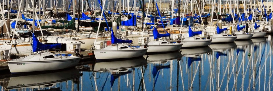
Monterey Bay — Breakwater Cove, Municipal Marina, and General Anchorage Area:
The first point to make here is that if you intend to proceed south, I highly recommend at least an overnight stop here for the Skipper and crew to rest. If you manage to get a slip in either marina the crew should shower, have a couple of nice meals out, take a nice long walk, and get at least one good nights sleep (more if you are not used to overnight passages). My own policy is to make sure there is a two-day weather forecast that you really like as the following stretch will be the longest without anywhere to go/do/stop. If not done already, this is where the Skipper should establish the watch schedule to impose upon departing. With a minimum of 3 crew members, I like a 4 hour shift on the helm, followed by a 4 hour shift on watch (see ColRegs rule #5), which subsequently allows for a 4 hour period of sleep. This schedule allows each crew member 8 hours of rest in a 24 hour period. When on watch they can relieve the helm when needed while being aware of current conditions. Nuff said about my watch schedule – back to Monterey Bay….
All services are available here including boat yard and fuel dock.
If you have not reserved a slip and/or they don’t have room for you inside the breakwater, the General Anchorage area is clearly marked just to the north of the breakwater. I have anchored here and it can be rolly as it offers little or no protection from wind or surf. Anchor well with plenty of rode while you also pay attention to the tide and weather forecast. This area is good to either wait until there is room at the marina or the weather forecast clears for a minimum of two days and you just go. This is a nice sandy bottom and good holding.
Going South: Depending on your boat speed it is something between 10 and 20 hours to the next stop of Morrow Bay. You should (at a minimum) stop here or have stopped at Half Moon Bay so the crew can rest and prepare.
Going North: If after sailing upwind from Morrow Bay, this is a great place to celebrate your accomplishment and let the weather settle for your next leg to Half Moon Bay or even San Francisco Bay.
Stillwater Cove at Pebble Beach:
This is just a couple hours around the corner from Monterey. While a legitimate anchor area, I don’t recommend this due to the rock hazards at the entrance. It does offer good protection if a storm from the North blows up, and some protection from westerly winds and surf, do your best to skip this and move along. I consider this a last-resort place to weather a storm. If going North, do your best to continue to Monterey – it’s close. If going South – stop here only if some storm took you by surprise.
Wreck Beach:
Another last-resort anchorage area. This has good holding ground but does not offer much of protection against anything. Use only in case of emergency. Remember: It’s named “Wreck Beach” for a reason. Avoid if possible.
The only reasonable stopping point between Monterey Bay and Half Moon Bay — San Simeon Bay:
This anchor area offers good holding and protection from both North and Western weather. It is not very big – comfortable for maybe 5 boats with swing area, so be careful. Very helpful if you are exhausted and just can not making if going south, or if you are going north and want to sneak ahead another 20 miles (north of Morrow Bay) to make sure a short weather window or uncertain weather report is something you want to tackle. While there is no fuel, there is a restaurant and general groceries here if you can get to shore with a dingy/kayak/SUP.
Going North: Use this if the weather is stronger if you want it to be and don’t want to have to return that 20 mile investment from Morrow Bay.
Going South: Unless a storm comes up, just power through and continue on to Morrow Bay if you can. All your supplies are there and protection from any storm.
Morrow Bay:
I recommend stopping here either Northbound or Southbound as you should celebrate your accomplishments and prepare for the next milestone in your journey. There is no haulout and very little in terms of marina space, there is plenty of both mooring balls and anchor areas as long as you can get your tender/Kayak/SUP to the many dingy docks. I waited here several days on a northbound journey and serviced the engines and sail drives as all of the supplies needed are here. The dining options are plentiful, there are several Auto parts stores within a short walk, and plenty of things to see. Enjoy this time to take nice long walks and stretch your legs!
Going South: Keep a keen eye on the weather around Point Conception. The wind and surf can both get high but you only need a 12 hour window. Don’t mess with the weather – this is a very serous section of the coast (I promise weather paradise once you get south of Point Conception. Keep your eyes peeled for a Starlink Launch from the nearby Space Force base at Vandenberg – quite spectacular but is over quite quickly…
Going North: This is where you will want to wait for good weather for what may be a 20 hour northward bash. Remember the prevailing winds blow north to south, so the entire western coast northward is called “The Baja Bash” for good reason. You will be motoring, so wait for a 24 to 36 hour weather window before moving on. There is plenty here to keep you occupied and this area provides some of the best protection against nearly any weather.
Point Conception:
This is not an anchor area, or a safe refuge. Instead to the sailor it is more of a phenomena. The prevailing north-to-south costal winds are concentrated on this land mass that sticks out into the sea. Check the condition of the 46218 weather Buoy (https://www.ndbc.noaa.gov/station_page.php?station=46218) before rounding either from the north or south. Be extremely cautious here.
Cojo Anchorage: This is located on charts just south of “Government Point”. It is not recommended unless there is an emergency or you just need to wait out the weather for a few hours without having to backtrack. There are some Coast Guard mooring buoys here also.
Going south: Once you have rounded Point Conception you enter a very large area of Southern California that will feel like a sailors paradise. Point conception does a great job of blocking strong winds and surf from here to San Diego and if you enjoy a fairly constant 10 knots of wind, knock yourself out. I recommend only a few days on Catalina on a mooring ball to celebrate how far you have come so far.
Going North: Use this anchorage again if you don’t want to back-track and just need to wait a few hours for the heavy waves and wind to settle down. I don’t recommend this for an overnight stay
Between Point Conception and Mission Bay:
There are hundreds of places to stop and enjoy as this is considered by everyone in Southern California to be the best sailing grounds anywhere (we in San Francisco Bay disagree). It’s calm, little surf, so enjoy as long as you like. Enjoy the Channel Islands, many marinas and ports of call. I typically have an agenda so after staying a day or so in Catalina, head straight to San Diego. When your direction of sail permits, this is the perfect time to deploy your spinnaker if you have one.

Channel Island Harbor and Marina:
I take it back. This harbor is a great stopping point to take on water and a rest. It is wide open and offers many services. The only caution is to watch for kelp in the area as I have had to dive the propeller to get it off!!!
Mission Bay Mariners Village and Marina Village. This area is far inland and protected from any weather, not that they get much in this area of Southern California. There is both an anchor area (the bottom seems clay and it was difficult for me to set my anchor here), and several large marinas both before and after the bridges. The marinas are sometimes not very friendly to transients but be persistent If you want to stay. There are some good dining options here.
San Diego Bay:
Marinas: There are many – 4 are even “Safe Harbor” marinas who share management with our own Marina Bay Yacht Harbor. The marinas closer to the city are very busy, more expensive, and full, so I recommend checking for slip-space with the marinas further away, such as the Chula Vista Marina, otherwise known as Safe Harbor Chula Vista – we have stayed here several days and there are all the needed facilities including a West Marine within walking distance.
Anchoring: Because most of San Diego Bay is a military security zone, you can’t just anchor anywhere for as long as you like. Checking on your charts, there are several designated anchorage areas starting with “The Shelter Island Yacht Basin Anchorage area A-1, through “The Glorietta Bay Anchorage Area A-5” (and probably some others – photo above was taken December 4, 2023 at the Glorietta anchorage looking toward the Hotel Del Coronado). Outside the bay, only the Zuniga Shoal, just off the North Island Naval Air Station runway, is unlimited and unreserved. This is somewhat protected but you feel a little exposed compared to being in the nice secure bay.
