Remember when you were just learning
to sail and the boat heeled over for the first time? My instructor was calm,
but I’m told I was yelling “Help! Yikes! Eeek!”…although I’m pretty sure it
was quite a bit more dignified than that. From ancient times to the present,
this feeling that the boat might capsize or sink has been, well, a concern, for good reason. It’s the space
age, and boats are still going to the bottom.
The Cretans established guidelines
for loading boats as early as 2500 BC, but it wasn’t until 1930 that there was
an international agreement on the standards developed by an Englishman named
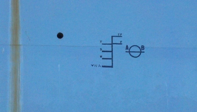
Plimsoll in the 19th century. That circle with a line through it
next to a sort of ladder graphic that you see on the hull of the Red Oak
Victory is the result. This represents the waterline maximum that the ship can
safely be immersed to, depending on season and salinity represented by the
various horizontal lines.
So what’s safe for our sailboats?
The Net Register Tonnage of Tradewinds’ Lionheart is 5.49, which means the volume that can be used for cargo or passengers is 549 cubic feet. The weight of this volume of water is 549 x 7.5 [gallons per cubic foot] x 8.333 [weight of a gallon of water] = 34299 pounds. So if the boat itself weighed nothing and it was filled with water, the volume of the boat would displace 34299 pounds of water. But the empty boat already weighs 9170 pounds, so if we subtract that from 34299 we get 25129. This is equal to about 405 cubic feet or a little over 3000 gallons or roughly ¾ of Lionheart’s interior volume. So if we fill Lionheart with 3000 gallons of water, she will weigh the same as the surrounding water and sink. But this assumes a perfectly stable, flat sea. Boating enthusiasts have adopted a much more conservative rule of thumb for capacity of passengers which you will recognize: length times beam divided by 15. On Lionheart this gives a capacity of 20, which is quite a bit more than you’re likely to have aboard. If we assume 184 lbs per person, we get a total of 3680 pounds, about 1/7th of what it would take to sink the boat. The other 6/7ths represents her reserve buoyancy, allowing that heeling, and downsizing my “Eeek!” to “Yow!”
Last
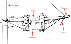
time we established that the yardarm is not the whole yard, but just the tip of
it outboard of the leeches, and moreover the commentators are all over the map
concerning which yard to use. Yet any part of the rigging, which is constantly
in motion, is a poor gauge for the altitude of a celestial body compared to the
sextant. And why use such a clumsy measurement to tell time anyway, since by
1899 when our phrase first appeared, the chronometer had been in use well over 100
years?
The
one thing the pundits all seem to agree on is that the sun rises over the
yardarm at 11:00 AM, sometimes adding for good measure “in the northern
hemisphere,” though they should know the hemisphere makes no difference.
As
the builders of Stonehenge understood, the sun’s altitude varies by the date.
At 1100* at the Tradewinds dock the sun was at a height of 50 degrees, roughly
the angle of the main yardarm viewed from the mainmast, on March 24 and again
on September 21. The yardarm will give the correct time twice a year. But by
October it would not rise to this angle even at noon, while at summer solstice
it would reach 50 degrees by 0916.
And
as Eratosthenes demonstrated in about 240 BC, the sun’s altitude varies with latitude.
So on March 24, the day the sun was at 50 degrees at 1100 here, it reached 50
degrees by 1014 local time in Hawaii, and never rose that high in Vancouver.
Were
18th and 19th century navigators such boneheads that they
were not aware of these fundamentals? Methinks not.
If
you’ve ever worked for a living or stood watch, you know the end of your shift
is not a matter taken lightly, particularly if grog is in the offing. For
regimentation of life aboard, for establishing the ship’s speed in dead
reckoning, and for longitude, the accurate measurement of time was crucial.
Nothing as vague as the sun’s proximity to a yardarm could ever have served.
But
don’t get me wrong. If I overhear you on the dock one day saying, “The sun’s
over the yardarm, mate,” I’ll know you’re not doing celestial navigation.
*Ignoring daylight savings, which would confuse
things
I had the opportunity to sail to the Farallon Islands recently as part of an “essential services” trip to replenish supplies and personnel that work on the island. It was an opportunity I couldn’t pass up. I have boated and sailed all over the world but I have never been out to the Farallon Islands. To say I was excited would be an understatement.
The islands are part of the City and County of San Francisco and managed by the United States Department of Fish and Wildlife in conjunction with the non-profit Point Blue Conservation Science. At any given time, there are five to eight scientists living on the island conducting field research on the mammals and birds that use the island for a breeding habitat. Point Blue utilizes volunteer boats to shuttle biologists and supplies to and from the island year-round. These supply missions are called “Patrol Runs”.
The weather in mid-May should have been relatively benign, with a higher potential for fog than during the winter months. However, a low system was forecast to come through the Bay Area and the trip, scheduled for a Sunday, was not confirmed until eighteen hours before departure. With the weather window now looking promising, we received the “GO” notice from Point Blue on Saturday afternoon.
Sunday morning, my alarm goes off at 0415. I’m not quite sure the last time I woke up this early. I’m out the front door of my house at 0445 and arrive at the Sausalito Yacht Harbor at 0510. It was raining when I left my house and driving over the Richmond San Rafael Bridge, but it has subsided now. Hopefully it won’t be too wet of a morning.
Due to COVID-19, our essential trip to restock the island was approved by the local police department, otherwise they would not have allowed us to park at the marina. The entire area had been gated off but we were granted permission to park. During the entire trip were to follow a strict protocol on wearing face masks and utilizing hand sanitizer. In addition, the boat crew were not permitted to step foot onto the island.
I greet the owner of the boat at “C” dock and he gives me an introduction to his boat, a 1980’s Beneteau 350. It’s perfect for the type of work we were setting out on. A few minutes later and another crew member arrives followed by the three biologists from Point Blue. We proceeded to load the boat.
Their gear consisted of x7 five-gallon propane bottles, ten large plastic boxes the size of large ice chests, x15 five gallon “Home Depot” style buckets filled with food, and all of their personal gear. These biologists were headed out to spend anywhere from five to seventeen weeks on the island. The biologists that we were bringing back had spent anywhere from twelve to eighteen weeks on the island. The Patrol Run frequency varies but the next scheduled trip out to replenish the island with supplies was not for another month after our trip out.
We left the dock at 0600 for the thirty nautical mile trip offshore. Low clouds persisted out past Point Bonita but visibility was still good to fair. The storm front that came through the night before left a decent sea state, with the Potato Patch in a 5’ to 7’ swell.
The wind had backed and was coming directly in line with our course for a straight route out to the island. Being on a strict timeline with a scheduled arrival at 1100, we had to motor out to the islands. As we slowly left the California coast behind us, the clouds started to clear and we had a beautiful blue sky in front of us. The choppy, coastal sea state also subsided into a gentle rolling ground swell. Nearing the NOAA weather buoy (Station 46026) eighteen miles offshore, the islands appeared in the distance, still some twelve nautical miles away.
The Southeast Farallon Island (SEFI) is the largest and only habitable island of the chain and was our ultimate destination. As we motored closer, there were more and more sea birds in the water and in the air. The area was teeming with life. We spotted something splashing in the water with Western Gulls looking on with curiosity. It was a small Mola Mola, aka Ocean Sunfish, about the size of a large dinner plate.
We were now about a half mile out from the East Landing, which is one of the two public mooring balls located at the Farallon’s. The other mooring is located in Fisherman’s Bay. Just then, a water spout from a whale’s blow hole shot up a few boat lengths off the starboard bow. How cool was that! As we motored past you could see a large Grey Whale catch another breath before diving below the surface in search of its next meal.
We picked up the mooring ball in 40’ of water at 1045, fifteen minutes ahead of schedule. We proceeded with setting up fenders on the port quarter. A small tender with two biologists was launched from the island to come out and start the decanting process of all the gear we had onboard. It took multiple trips to get all the gear to the island.
There is no dock on the island, so the small tender had to be hoisted out with a shoreside crane for each trip. Pretty fascinating to watch, given the swell rolling through the area. You could tell the biologists have done this before! Along with the supplies we brought out, we would also load our boat to bring back with us the trash, recycling, science equipment, and personal gear of the three biologists that were leaving the island.
At 1245 we cast off the mooring line and depart for a circumnavigation of the island. There is so much life out there. Especially during this time of year when hundreds of thousands of birds call the Farallon’s home for raising their offspring. After spending so many months on the island, it was really interesting to see the biologists and how excited and surprised they were to see the island from the water.
Finishing the circumnavigation, it was time to hoist the sails. The wind had backed further and set us up for a great beam reach to broad reach run all the way back to the Golden Gate Bridge. With sails hoisted we turned off the diesel engine and all was quiet. Just then, we looked out over the port side and not even one boat length away was a very large Mola Mola, the size of a dinner table. One word, epic.
As we approached the San Francisco bar, the wave height increased and became a little bit of a confused sea state. Not helping the situation, we were approaching a tidal change just off Point Bonita. Even so, the downwind sailing continued to prove exciting, with small surfs down waves up to ten knots. Not that impressive for a racing yacht but we were in a loaded down “RV” on the water.
We crossed under the Golden Gate Bridge and a few gybes later it was time to lower the sails and motor into the Sausalito Yacht Harbor. It was a great day out on the water and what an honor to be able to provide a valuable service to a non-profit organization that does some great work out at the Farallon Islands.
Also, don’t forget to check out my personal blog that covers my sailing adventures as crew in Leg 5 of the Clipper Round the World Yacht Race. Make sure to watch the YouTube videos too! Follow along and don’t forget to subscribe to get the latest updates.
A “yardarm” is not the entire yard, but just its tip outboard of the leeches of the sails. Some authorities commenting on our phrase suggest instead that we use the “upper yards,” while others recommend the “foreyard,” which is the lowest yard on the foremast, for our observations. But both require looking forward, through the sails. Sails are, um….opaque–not to put too fine a point on it. Hard to look through. To complicate matters, yards are raised, lowered, and rotated both vertically and horizontally. And where do we make our observations from? It’s quite a muddle.
Because it’s the word used in the phrase, I favor “yardarm” as opposed to “yard.” Otherwise, we’re going to have to change our course towards the sun, a non-trivial matter for a square rigger. The lower main yardarm would give an angle of, roughly, 50 degrees above the horizon viewed from the base of the mast. Adjustment of our heading will not be necessary, there being a wide view to either port or starboard as we draw an imaginary horizontal line at the height of the tip of the yard.
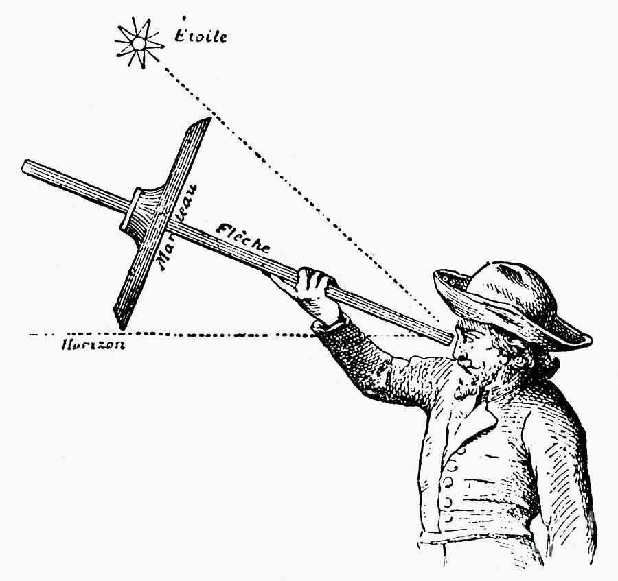
Yard or yardarm, however, few things would be of less use in gauging the altitude of a celestial body than the rigging. Mariners have long sought to isolate their observations of the sun, moon, and stars from the motion of the boat through use of the cross staff, astrolabe, backstaff, octant, and sextant. Yet the masts and yards actually amplify the roll and pitch of the ship, just what you don’t want.
Cross staff
And why use the altitude of the sun to tell time? By the period our phrase appeared in 1899, Harrison’s onboard chronometer had been in use for well over 100 years. Before that, time was kept by 30-minute sand glasses. In Columbus’ day noon was established by means of a gnomon, or vertical spike, in the center of the compass card. When the gnomon’s shadow fell on the card’s north, it was noon, and the glass would be set for a new day. Even though the difference between magnetic and true north was not yet understood, this demonstrates that Columbus knew that it wasn’t the sun’s altitude (which the yardarms could supposedly measure) that was at issue, but the time of meridian passage.
Shiver me timbers, this is all sounding very shaky. But IF we wanted to tell time using the yardarms, how would we do it? Tune in next time.
It is
well understood that sailing while inebriated is a very bad idea. It’s contrary
to Tradewinds policy, and it’s against the law. But even on one’s own boat,
offshore beyond the reach of society’s sanctions, the notion that one can
confront the sea with less than his best game represents a cracking good
example of overconfidence.
All this
being granted, one would have to be living under the proverbial rock to be
unaware of the fact that hard drink has a long association with sailing—so long
that it was less than five decades ago that the British Navy abandoned its
daily distribution of alcohol to men on warships. It’s hard to believe they
were drunk while blasting away at the enemy with cannon fire in all those
legendary battles. But come to think of it, it’s just as hard to believe they
weren’t. The practice has spawned a whole category of colorful phrases like
“splice the main brace,” “groggy,” “three sheets to the wind,” and “the sun’s
over the yardarm.” The first three of these are amply defined in Admiral W. H.
Smyth’s commodious lexicon of 1867, but the last goes unmentioned despite the
author’s obvious fondness for salty language. In fact it doesn’t appear until
1899, well past the golden age of sail, when Rudyard Kipling uses it in Sea to Sea, and even then not in a
particularly nautical context. In a passage excoriating the loutish behavior of
Americans, he writes: “As you know, of
course, the American does not drink at meals as a sensible man should. Indeed,
he has no meals. He stuffs for ten minutes thrice a day. Also he has no decent
notions about the sun being over the yard-arm or below the horizon. He pours
his vanity into himself at unholy hours, and indeed he can hardly help it.”
Yeah, Rudyard, but we won the Revolution.
Nevertheless
we can ask, just what is a “yardarm,”
anyway, and how do we use it to measure the height of the sun? Having
accomplished that, how to we convert the sun’s altitude to establish the time
of day? Can it have been this easy to tell the hour by just looking up at the
rigging? Even though the answers to all these questions are of no use
whatsoever to the modern mariner, they will be the subject of our next few
installments.
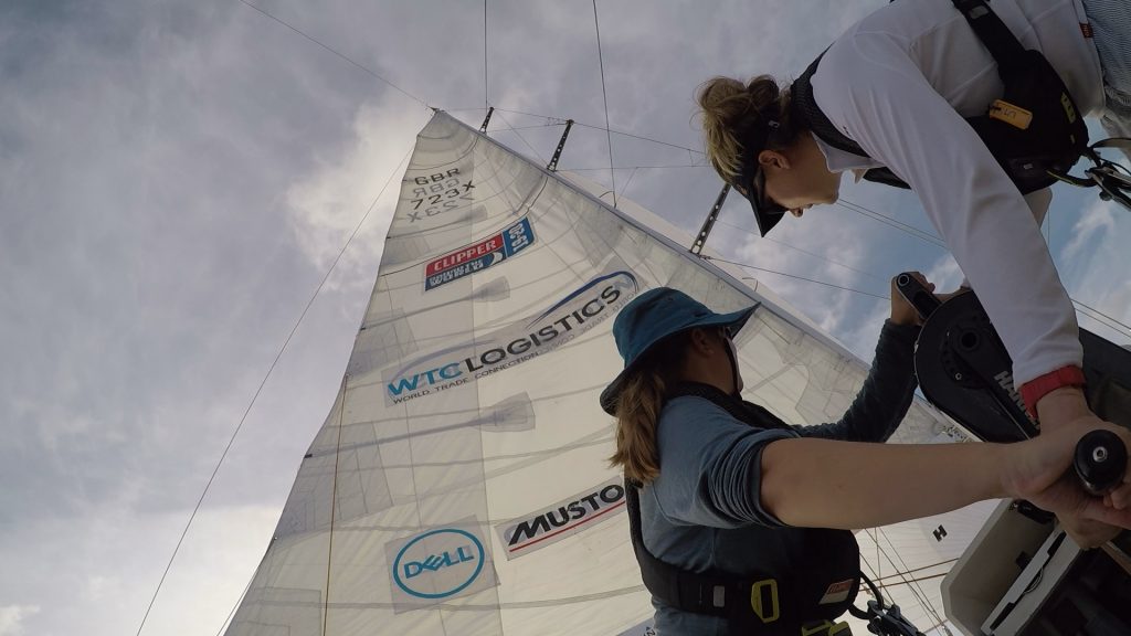
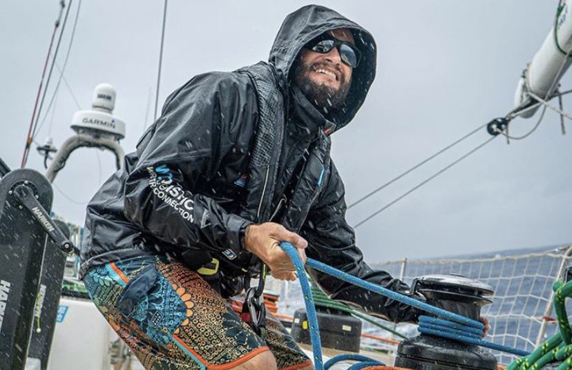
By: Mike Holmes – Assistant Watch Leader – CV23 – Team WTC Logistics
At the start of January, I headed off on an adventure, sailing as crew and assistant watch leader in the 2019-2020 Clipper Round the World Yacht Race, an ocean yacht race for amateur sailors. I participated in Leg 5, with the original scheduled route from Australia to China. With the COVID-19 outbreak our plans would change, but more on that later.
During the race, myself and 17 other crew spent 37 days at sea, sailed 6,000 nautical miles between 2 separate races, crossed the equator, spent hours becalmed in the doldrums, and experienced the high of a race win and low of a race loss. What an experience it has been!
Crew on spinnaker sheet grinder / Mike Holmes
The eleven 70’ one-design yachts left London in September 2019 for the 40,000+ nautical mile journey around the world, broken into 8 separate legs, and taking 11 months to complete. The yachts had left Fremantle, Western Australia in December and were due to arrive into Airlie Beach, Queensland, Australia around the 11th of January.
I had arrived at the Coral Sea Marina in Airlie Beach on the 8th of January. I was able to spend time exploring the area including a few snorkeling trips to the Great Barrier Reef and a trip to Whitehaven Beach. Such a beautiful part of the world, outside of all the aquatic creatures that can kill you! Think sharks, salt water crocodiles, Irukandji and Box jellyfish!
The race was originally scheduled to depart on January 18th but we were delayed by 48 hours due to two of the boats not having operational water makers. Heading out into the tropics on a water ration of two liters, per person, per day was doable, but not recommended.
We departed the Coral Sea Marina on January 20th, but it would be another two days before the actual start of the race. We were to motor through the Great Barrier Reef and start the race just offshore, but the lack of wind postponed the race start. Because of this, we continued motoring north of east, towards the Solomon Sea.
This delay of 24 hours allowed the fleet to stop for an afternoon swim in 1,400 feet of water in the middle of the Coral Sea. What an amazing experience to jump off the yacht and try to “cool off” in 86-degree Fahrenheit sea water.
The next day, January 22nd, the wind had filled in and we were able to start the race. This would be a LeMan’s start, where all eleven boats lined up abreast of one another, with a full mainsail up, head sails rigged to hoist, and motoring at about 7kts speed over ground. Crew are required to stand behind the aft coffee grinder prior to the start. With one minute to go the engine is shutoff. The countdown is conducted by a designated lead skipper over VHF radio. At ZERO, the crew rush to their predesignated positions. The boat that can hoist and trim their head sails the quickest will lead the fleet off the line.
Upwind sailing / Mike Holmes
We were located the second boat to windward with all boats on starboard tack. I was one of the sweaters, so my role was at the mast, hoisting the large yankee head sail by pulling down on the attached halyard. The yankee 1 is only 1,255 square feet of sail that has to be hoisted to the top of the mast, some 95’ above the waterline! Race start went smooth and within the first hour we were in the top half of the fleet, which isn’t saying much in a 4,000+ nautical mile race! We had a long way to go.
It would be light wind sailing for the next few weeks. After about a week at sea we received notice from the race office of the corona-virus (COVID-19) that was being reported as an outbreak in China. We didn’t know the extent of it but we were told it would most likely affect our race. About two more weeks went by before the official word came out that our race finish was being changed from Sanya, China to Subic Bay, Philippines. We were disappointed by this news but understood the reasoning and it ultimately played into our favor.
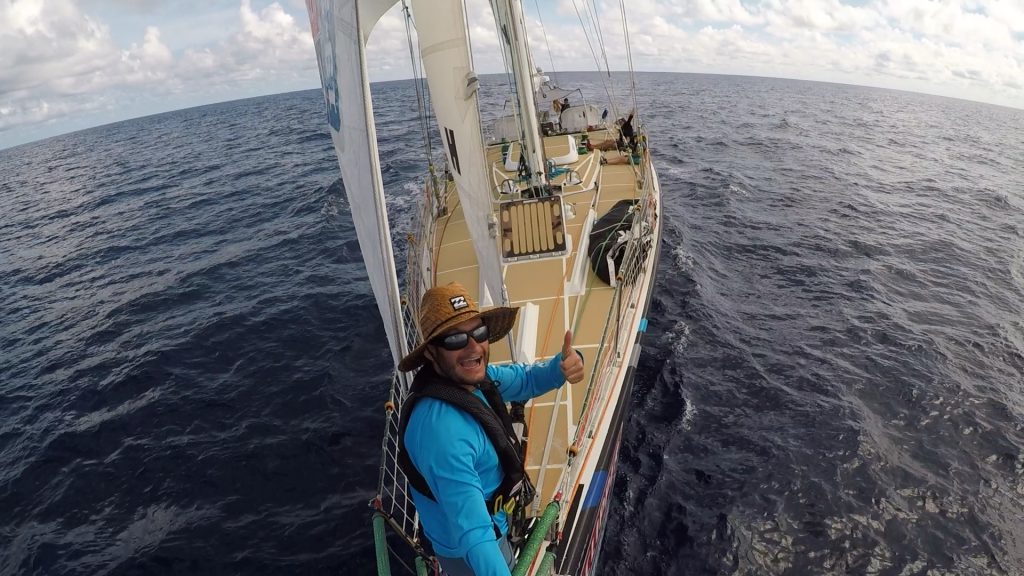
Bow selfie / Mike Holmes
As we left the Coral Sea and entered the Solomon Sea, the doldrums motoring corridor lay just ahead. Doldrums are the nickname for the Inter Tropical Convergence Zone (ITCZ), an area known for light winds as weather patterns from the northern and southern hemisphere converge.
Mike using a boat hook as a spinnaker pole to keep the windseeker filled in 1kt of wind / Sophie Owles
This section of the race course is aptly named due to the fact that teams can opt to turn on their engines. Wait? What? I thought this was a sailboat race? Let me explain, in order to maintain an arrival window to the next port and keep the overall program on schedule, teams can motor through the doldrums.
For this race, teams could motor between 8 degrees south and 4 degrees south, a distance of 240 nautical miles and roughly where the doldrums were located at this time of year. The caveat is you have to motor for 36 consecutive hours. If you arrive at 4 degrees south before the 36 hours is up you must wait there until time expires before proceeding north. If you started motoring too early you may be short of the 4-degree marker. The motoring corridor would present itself as the first chance for a tactical maneuver.
Our skipper reviewed the weather forecast (GRIB files) and made the call to delay our motoring corridor start to maximize the amount of northerly latitude we could gain within the hours allocated for motoring. We were towards the very back of the fleet entering the motoring corridor as all the other boats had started their motoring prior while we were stuck in a wind hole.
Luckily the weather forecast was correct and soon enough the wind built and we started to catch up with the rest of the fleet. As the competitors ended their motoring corridor time allocation, they were still short of 4 degrees north and they ended up in a wind hole. We continued to motor past them and went from last place to 2nd place. It was a brilliant tactical play and set the stage for the remainder of the race.
We continued north and after 12 days at sea we crossed the equator on January 31st at 0 degrees 0.00′ north, 151 degrees 5.249′ east. It was in the middle of the night as we crossed but all the crew were awake and on deck to mark this special occasion. King Neptune would hold his court later that day.
A seafarer tradition, all crew that cross the equator for the first time have to attend King Neptune’s court. This is the ceremony where the crew go from being a pollywog to a shellback. This includes confessing a boat sin and having to eat a special mixture from Davy Jones’ galley. Let’s just say, I’m glad I have already crossed the equator before, in 2008 aboard the T/S Golden Bear with the California Maritime Academy.
As we continued heading north of west towards the Luzon Strait, some 2,000 nautical miles away, we went from wind hole to wind hole. This required constant sail changes with the most used sail being the windseeker. This large, light wind sail has an area of 1,750 square feet and is a cross between a yankee head sail and a small spinnaker. It is most like a gennaker sail. Once the wind would approach 10kts apparent wind speed this sail would be dropped and a yankee head sail hoisted. In addition, we were also constantly hoisting and lowering the stay sail which only provided benefit above 7kts of apparent wind.
Finally, a low-pressure system developed that we could utilize to slingshot ourselves towards the northern tip of the race course. In a matter of 24 hours we saw the wind build to 25kts+ with a sea state between 3 meters and 4 meters. With the wind just abaft the beam it was great spinnaker weather!
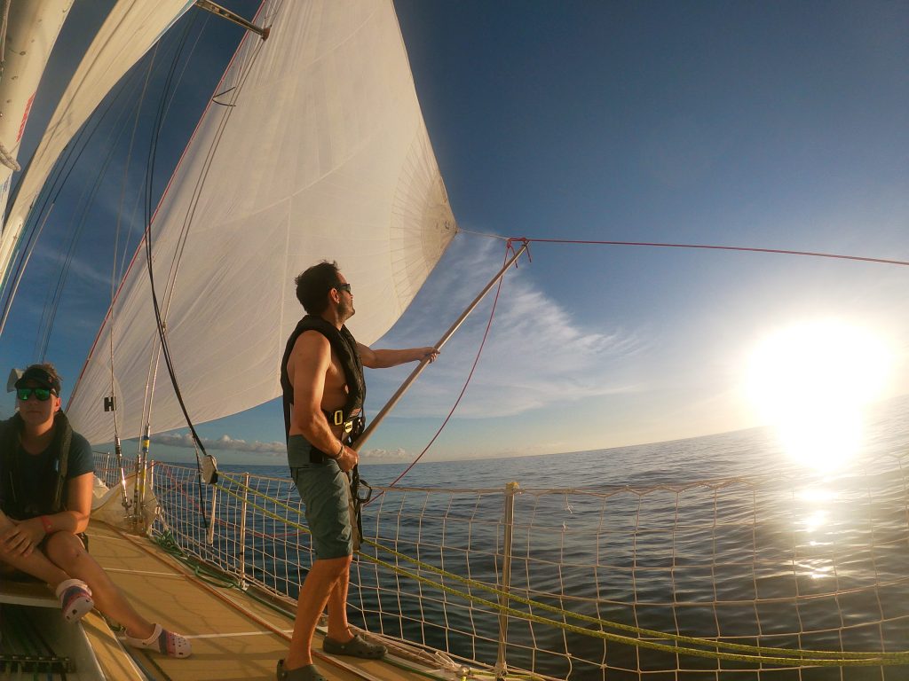
Mike adjusting the stay sail working sheet / Maeva Bardy
Our spinnaker of choice was the Code 2, which has a sail area of 3,465 square feet and is rated for up 20kts of apparent wind speed. It was so much fun on the helm of a 70′ ocean racing yacht with a spinnaker up in a moderate to rough sea state. I was in a constant state of bliss, surfing a 49-tonne yacht down waves at speeds up to 20kts SOG.
Our position on the race course, sitting about 6th at the time, was favorable to this low-pressure system and we saw massive gains on the lead yachts. Every 6 hours we received an update from the race office on our position relative to the fleet. It was encouraging as we continued to decrease the distance to the boats in front of us. Our skipper reminded us, focus on the boat in front, once we pass them then focus on the next boat, don’t worry about the front runners. At this point we thought we may be able to get on the podium in 3rd place.
As we exited the Luzon Strait and entered the South China Sea, the next tactical decision was to head inshore or offshore as we raced south towards Subic Bay, Philippines. The two lead boats headed offshore, but the weather forecast showed an inshore route that could potentially be favorable. Our skipper opted for this inshore route. It would be a few days of chutes and ladders before we knew if we had made the right tactical choice.
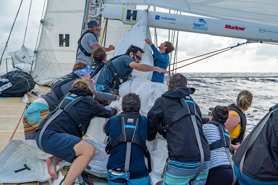
All hands on deck for a spinnaker drop / Maeva Bardy
48 Hours later and we were chasing down 1st place. At the same time, the two boats that were leading a few days prior but offshore were now in 3rd and 4th place. They altered course and dove deep inshore, which saw them sneak up on our inside. With only 100 nautical miles to the finish it was still anyone’s race. At this point we saw the first-place boat head slightly more offshore in search of a little more wind. Our skipper took the helm and was able to keep the inshore boats at bay. All of a sudden, we found ourselves sitting in first place.
The next 12 hours were intense. Not only from a sailing perspective, but from a mental perspective. We knew we were capable, but with the variable wind and the top boats breathing down our transom, we knew we couldn’t ease off or celebrate until we crossed the finish line.
I remember going to bed that night, hearing the whooshing sound of water along the hull adjacent to my bunk. That was a positive sound, a sound that we were moving through the water at a good speed towards the finish line. Then the sound stopped.
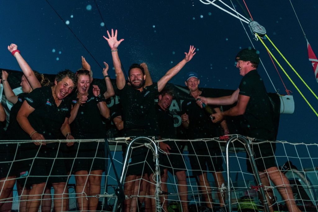
Another bloody wind hole! I came on deck for my watch at 0200 with only 25 nautical miles to go in the race. I started praying to the wind gods, and literally the wind started to pick up. It was a very surreal moment. The wind started to build and back, which gave us a lift towards the finish line. With no other Clipper boats in sight the thought of a 1st place was getting more and more real. A few tacks and a few hours later we crossed the finish line in 1st place! It was a feeling and a moment I will never forget.
Once across the finish line it was time to drop the sails, put up the sponsor flags and prep to enter the marina. 50 Minutes later and we were dockside, celebrating 26 days at sea, 4,300 nautical miles, and a win of Race 6 in Leg 5 of the 2019-2020 Clipper Round the World Yacht Race. It doesn’t get much better than this!
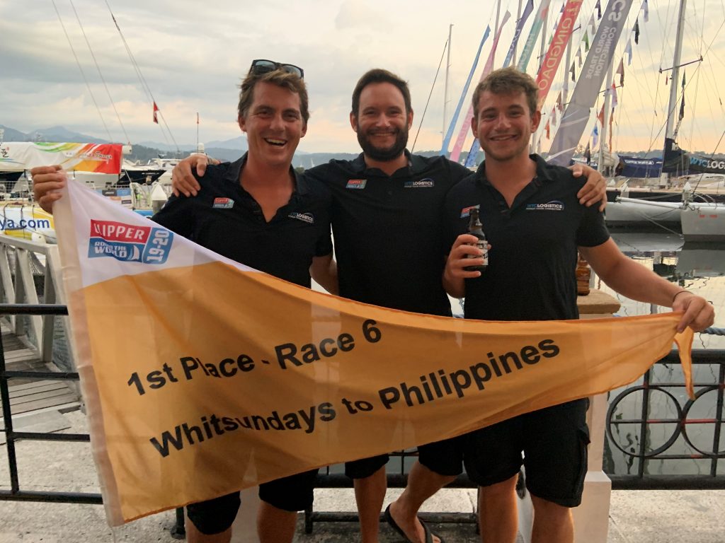
Skipper Rich Gould (Right), Myself (Center), and 1st Mate Dan Jones (Left) / Sophie Owles
We spent the morning celebrating, drinking champagne, beer and then gorging ourselves at the all you can eat buffet located at the Subic Bay Yacht Club. That afternoon I checked into my hotel and had the first proper shower in 26 days. One word, luxury.
Our stopover consisted of doing a deep clean of the yacht, followed by a few maintenance days. We ended with the prize giving ceremony, another moment I will never forget.
Celebrating our win! / Clipper Ventures PLC
Due to the corona-virus, Clipper made the choice to not continue on to Zhuhai, China where Leg 5 was supposed to finish. Instead we would do a 1,600 nautical mile race up towards Japan and back, ending Leg 5 in Subic Bay, Philippines. I was bummed but knew it was the right choice for the safety of the crew, Clipper employees and supporters.
We had a few days off before the start of the next race. Half of our crew opted to go on vacation together and we flew to Boracay Island in the Philippines. Some well-deserved R&R was in order.
Back to the boat on February 21st, it was time to go racing again, departing on Sunday, February 23rd. We were in high spirits coming off our race win and knew we were capable of potentially getting on the podium again.
This race course would see light wind sailing up along the east coast of Luzon before the wind would build near the Luzon Strait. The race started and it was close quarters racing for the first 24 hours.
As we entered the Luzon Strait, we opted for a more easterly route that showed promise based off the weather models. This was a tactical move we thought would play in our favor. As in life, if you follow the masses you may or may not make marginal gains on your competitors. If you take calculated risk you may make massive gains, or fail miserably. We made a choice and went with it. It would be four days before we knew if our decision would pay off.
Upwind sailing can be exhilarating, with the boat heeled over at 45 degrees, powering through waves, green water over the bow, it’s absolutely amazing being on deck. Below deck it’s another story. Half your time while ocean racing is spent below deck, living. Simple tasks such as cooking, eating, sleeping and using the bathroom become a laborious task when heeled over. Now spend days in a row doing this. It became a true test of mental and physical resilience. It also gave me major respect for those that have done the big ocean crossings and those doing the circumnavigation. It is not easy.
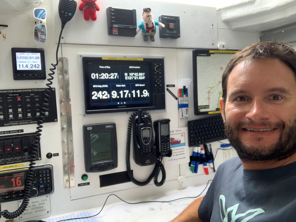
Myself in the navigation station / Mike Holmes
Unfortunately for us, the weather did not play to our favor this time. We rounded the northern mark of the race course in last place. Disheartening, but we knew we were fast and could start focusing on the next boat ahead. We spent the next few days trying to reel in the boats in front. Sometimes we would cross paths, and pull ahead, only to be overtaken again. This went on all the way to race finish. With less than three nautical miles separating us, currently in last place to 10th place, we hit another wind hole.
And that was it, the race was over. The course had been shortened to ensure we all arrived in port in time for the crew change over on March 6th. My Clipper journey had come to an end. Our team was not discouraged by the defeat of finishing in last place. We knew we raced hard and in racing sometimes tactical choices don’t pay off. It was a life lesson and we were content with the outcome. We agreed with our skipper when he said he would rather have a first place and last place than two mid-fleet finishes.
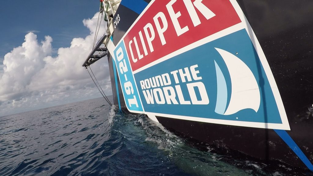
Bow at the waterline / Mike Holmes
The Clipper Race experience exceeded my expectations. I grew as a sailor, focusing on my helm work, spinnaker work, weather routing and directing a team as Assistant Watch Leader. I also developed friendships with my crew and crew on other boats that I know will last a lifetime. I was fortunate enough to be able to do this experience and it wouldn’t have been possible without the support of my loving wife. We both agree, live life with no regrets.
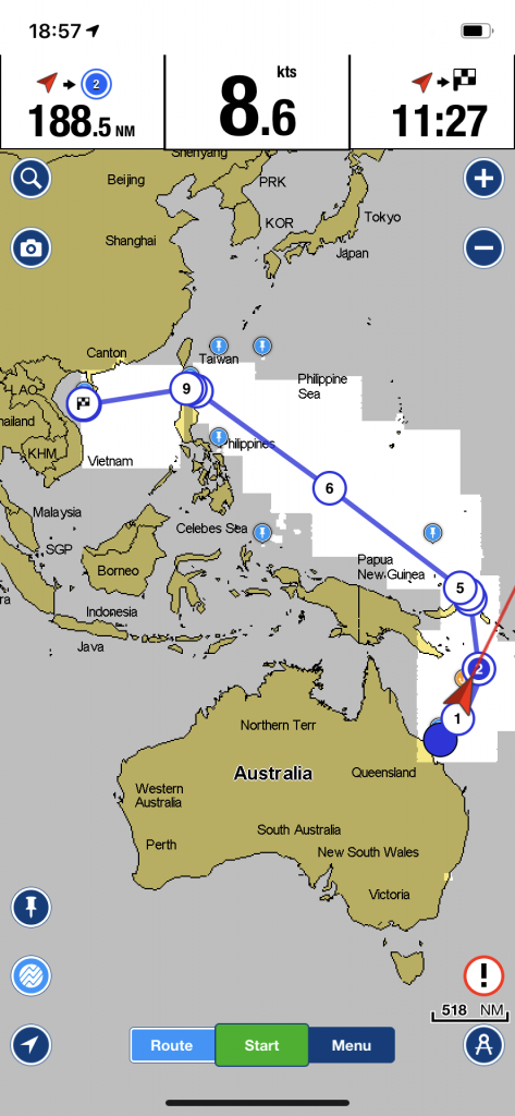
Screenshot of Navionics chart showing original race route from Australia to China / Mike Holmes
If you want to know more about my trip, check out my blog at:
In your intro to navigation you’ll be shown charts
that display soundings in feet, fathoms, and meters. These units are entirely
arbitrary, generated not by science but by history, the details of which are
often murky. Ancient units were often, naturally enough, generated from human
body parts: a foot (now standardized to 12 inches), a step or pace (which
became the yard, 36 inches), a hand (4 inches), and a fathom (6 feet), which
was originally the outstretched arms of a man. The
meter is ever-so-slightly more scientifically based (don’t
trouble yourself with that link) and is part of the International System of
Units, abbreviated SI, the most commonly used system worldwide but not here.
In America, we consider it our patriotic duty to avoid being like everyone
else. This makes communicating with others a bother, which it should be. We
also have red, right, returning although much of the world uses green, right,
returning. We pity them.
Nautical history, being long and multicultural, is a
mish mash of all kinds of terms and units of measure like “chains” (66 feet)
and “shots” (roughly an ounce unless you’re friends with the bartender) or “shot
of chain” (90 feet or 15 fathoms) which is a different unit from chains or
shots. A shot is usually the same as a “shackle” but I wouldn’t count on it. The
“chain” is more of a lubberly term; one-quarter of a chain is a rod, and 80
chains is a furlong. But what you sailors want is a “cable”
(I wouldn’t read that either) which is 120 fathoms or 720 feet American
although the French, with their hoity-toity SI system, say it is 200 meters
which works out to about, although not exactly, 109 fathoms.
The fathom, as far as I know, is always used for
depth. (Don’t go into the Home Depot and try to order five square fathoms of
carpeting. Or actually, go ahead, give it a try.) Thus we have the phrase, to
“deep six” something, based on the tradition of burials at sea, which require
the body to be lowered to at least six fathoms. Still, in clear water, this
would not obscure the remains of the departed.
So, to summarize, as a practical example we can give
the following. Once I sailed through the Corinth Canal. The canal is 28 stadia
or 23 cables or 256 chains or 9/10 of a league or 2816 orguia, if it’s easier
for you to think in those, or 16,896 feet or 1,024 rods or 25.6 furlongs or
9,300 cubits (in biblical cubits; but of course in classical Greece, it would
have been 11,140 cubits, due to inflation), 3.202168898848118 statute miles, or
for us sailors, 2.7826086956521739 nautical miles long.
I hope this clarifies things.
Is there a salty term that you’d like to know the meaning or origin of? Many of of the terms and sayings that we use in every day life have nautical origins. Send us your questions and we’ll pass them on to Tony for thorough research and explanation!
Capes, points, and headlands are difficult challenges for mariners. If you have been certified at the BKB level, perhaps you have already encountered a problem returning to Potrero Reach from Keller Cove, the open area between Point Richmond (the old ferry dock) and the Chevron Pier. Sailing upwind against an adverse current, you may have found it frustrating to try to turn the corner past the pilings, each tack seemingly depositing you right back where you started. This is the same issue, on a somewhat grander scale, that makes rounding Cape Horn, or any other cape, nearly impossible in the wrong conditions. In 1905 a full rigged ship named “Susanna” took 99 days to make it around Cape Horn, the longest rounding in history.
Conquering such an obstacle, so that land is now between
your present position and your previous one, is called “doubling” a cape or
point. This term, one of the oldest in the literature of the sea, is first
found in that grandfather of all sailing yarns, Homer’s Odyssey. In book IX Odysseus reports that “…just as I doubled
Malea’s cape, a tide rip and the North Wind drove me way off course,” and that
is when his famous troubles began. Every sailor knows the anxiety of such
roundings, and 3200 years later the Sailing Directions warn the mariner to
approach this cape on the southern tip of the Peloponnesian peninsula with prudence,
for the exact reasons Homer describes.
Those with BCC certification may attempt to double Point
Campbell on the NW corner of Angel Island or Bluff Point on the SE tip of
Tiburon, sometimes tacking against the current on the way into Raccoon Strait. After
BBC, your sailing area expands beyond the line between Peninsula Point at the
tip of Belvedere and Point Stuart on Angel Island. You may fight a fickle
breeze and a contrary current when attempting to get past either one. After
ACC, you’ll be rounding Point Bonita. Who knows what distant capes and headlands
you may one day double.
One of the wonders of our sport is that through the
traditional terms, the ancient skills, and the timeless wind, sea, and
geography that we share with the legendary sailors of olden days, we can relive
some of the most stirring adventures in history–even if all we set out to do
is to double Point Richmond.
Presidents Day — sunny, nice, sometime after one in the
afternoon — my friend Kriya and I were heading back to Tradewinds on a Capri
22. We were ending a short yet enjoyable sail along the Richmond shoreline. As
we motored down the Ford Channel, we wondered what all the hubbub at the
Craneway Pavilion was about. TV vans lined the pier-side, a loudspeaker was
going, and crowds thronged around the building. My friend checked her phone.
“It’s a Bernie Sanders rally!” The candidate himself was speaking at that moment,
being transmitted over the loudspeakers.
Another boat passed us port to port, and after we passed I
kept steering fairly close to the red right-hand marks — I was noticing some
kayakers on the port side, milling around in front of the Rosie the Riveter
National Historical Park building, apparently there for the event too. Wouldn’t
want to hit them.
Less than two minutes later, just as I was about to turn left into the harbor, I grounded Alpha in three feet of water on the mud-bed. This happened as I was looking ahead to the entrance of the marina and at the shoreline concrete steps that mark the inside of that turn. I did not realize immediately what had happened; the boat simply stopped moving ahead. (Look down, Joyce!) I looked at the outboard — had the engine died? No, it still hummed. Had it slipped out of gear? I moved it to neutral, then to reverse—alas too briefly, as glanced nervously at those concrete steps which seemed quite close… then at the end of the breakwall (Look down!) I tried revving the throttle up — obvious No Go.
Looking back, my gaze took in the kayakers and the last red
channel marker we had passed, three or four boat lengths away. It was almost
low tide, probably at about zero just then. I looked down past the transom, to
a pretty clear view of mud beneath the surface of the water. “Oh no, we’re
grounded! We’re on the mud!” I asked Kriya to move over to port side with me,
and we leaned outboard with our combined weight. The boat shifted a little but
sideways only. Illogically, I had the outboard still in forward gear. Did I
think it was just a thin mud bar we could simply slide over? Or that the boat
was oriented parallel to the margin of shallowness and we could simply slide
forward and away from it? I pushed the tiller hard over to starboard, as if
trying to achieve this. Belatedly, I came to more sense and put the motor in
reverse for several seconds at both low and higher throttle. No go. I had
missed my window of opportunity for this to be effective!
I had Kriya call Tradewinds. She handed me the phone and
Angie answered. I explained we were grounded outside the harbor entrance. She
said we’d likely have to wait until the tide rose again. Understandably, they
couldn’t come and risk having another boat grounded as well. Chagrined, and
hoping for a quicker resolution, I said we were not far outside the channel
proper, maybe five or ten feet, and said I thought a tow boat could stay in the
channel and throw us a weighted line, and we could catch it (I said this while
eyeballing the throwing distance — yeah it might work! I could catch that!) And
to my great relief, I was told to wait about fifteen minutes and they’d come in
a whaler. Also, to drop anchor. I told my crew this with relief, and then went
forward and dropped anchor (another first).
Just then a man in a yellow kayak paddled over from the
rally area and asked if we were grounded or anchored. “Both, but grounded
first,” I replied. “Do you want me to kedge your anchor? Do you know what a
kedge is?” Yes, and yes! I lifted the anchor (no great distance) and he put it
atop his kayak and paddled towards almost the center of the channel (while I
paid out the rode) and dropped it. I then worried aloud that it would be a
hazard to any traffic going into and out of the marina. The paddler said it
looked quite deep, it was no problem. Maybe about 30 feet of rode was out?
I then pulled hard on the rode, urging the boat to
dislodge. It did move a ways. Kriya joined in pulling as hard as we could. The
rode was at an oblique angle to the boat. Maybe it wouldn’t fully work at that
angle? But it was the only angle possible, as mud was at our front and other
side. We led the rode back to the halyard winch, and a bit of grinding seemed
like progress for a few moments, but then we felt we might just be dragging the
anchor towards us at this point.
The kayaker used his paddle to measure that we were
grounded in about three feet of water. At his suggestion, my crew and I tried
shifting our weight from port to starboard side to try to rock and dislodge the
boat. “No, you’re pretty stuck.” I thanked him for his time and said help was
coming, and he paddled back to the rally area.
I spent that time sitting near the bow, feeling embarrassed
and disappointed at my obliviousness. Now looking back at the wavy line of
channel markers, it was clear we’d crossed over to the outside. I had been
distracted, looking much more to the left than to the right side, and had
strayed too far from that range of markers as we passed the terminal one. My crew,
on the other hand, seemed to take it in good humor. “We have a front row seat
to the rally!” She filmed a cellphone video as we waited, interviewing me about
where we were, and how it was such a nice day to be grounded, or something like
that.
I instantly cheered up on seeing the whaleboat approach,
with Angie at the wheel and Steve coiling a long length of line, to which was
attached a pink weighted ball. As they slowly neared, I readied for a catch,
but instead we were told to to sit down, under the boom, for protection from
the weighted end. I held up the flotation cushion near our faces for good
measure. After a few initial throws, and with boat hook in my hand ready to
pick up a short throw, a perfect toss by Steve arced the weighted line through
the space between mast and furled jib. I scrambled eagerly to cleat it at the
bow.
Then the tow began. Slowly, Alpha dislodged! I took up the anchor rode as we moved ahead. The hard part for me was pulling up the anchor out of the water once it was directly under the bow. That little Danforth really holds. Our rescuers directed us to start our outboard marine engine mounts, and a moment later, the anchor had freed and we could lift it back onto the boat. We were free!
I returned the tow line to Steve and Angie. Our boats
motored back to the marina, both docking at the same time. I thanked Steve and
Angie for all their help. “You saved us!” I said I had definitely
learned a good lesson and hoped never to repeat it. Angie said it was good we
had grounded so close to the marina, and Steve quipped that it had made for a
fun part of his day.
Later, at the clubhouse, Angie spread out a chart and other marked maps and shared some fascinating info, including soundings she had done in some shallower-than-expected areas in the Ford channel, Ayala Cove, etc., especially at low tide. A large amount of sedimentation had happened after the Oroville Dam break three years ago. My takeaway from the charts was to stay in the center of the channel when no other traffic was present, and to keep at least three feet away from the channel markers, as sedimentation had encroached past them. Also, she showed that the rocky corner at the harbor entrance was not too much of a depth hazard several feet from the shoreline — no need to over-avoid them, especially with a light northerly wind as we had today…the mud was the lee shore, not the rocky side!
If you’re looking for Lake Powell houseboats for sale, then you’ve found the right place to start your search. Here you will learn about the boat, the amenities it offers, and even how you can find the information you need on the internet. If you are an active boater who likes to travel often, then this may be a great option for you. But if you just need a houseboat for vacations and you live out of state, then we have some great Lake Powell houseboats for sale in our Powells Paradise region. We have all of the features that you would expect from a houseboat including full kitchens with stove, refrigerator, microwave, etc., two or three cabins, decking, boat storage and Kayak Storage space for storing boats and kayaks, a serving room with stocked bar, and a comfortable boat seat. For other houseboats for sale, take a visit at ListedBuy web page.
Reflecting on what happened, I learned three things. One,
to always maintain situational awareness in all directions. Over-awareness of
potential hazard on one side (kayakers, rocky shore) should not have lessened
my focus on staying within the channel. Two, to immediately recognize when one
has grounded — in the case of a small boat of less than five-foot draft, just
look down. Three, to respond immediately by reversing, along with
shifting body weight to try to heel the boat away from the grounding side. What
else? The Tradewinds staff can share wisdom on this. And, they are awesome!
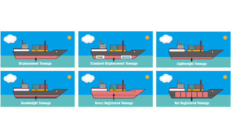
Last time we distinguished three sorts of tonnage
applicable to boats: displacement, deadweight tonnage, and gross and net
register tonnage. The displacement of your sailboat will be given in the
owner’s manual. The deadweight tonnage is not normally a big issue, as we do
not use our boats as cargo vessels. Cruisers, of course, must consider how much
weight to carry before it will adversely affect the sailing characteristics of
their yacht.
The third measurement, gross register tons or GRT, is a
measurement of volume, not weight. On cargo ships this measurement is done
professionally as it relates to tax revenue. But on recreational boats, you’re
on your own. Emails to Catalina Yachts on this issue were not answered, and at Beneteau
I was informed that the manufacturer does not provide the register tonnage of
their boats. The only reason this would matter to you is if you desired to
document your boat with the Coast Guard instead of getting a CF number from the
state of California. The federal documentation includes boxes for gross and net
register tons, but the state registration does not require it.
Basically, you calculate length x beam x depth, multiply
by two factors they give you to account for hull shape and keel type, and
divide by 100. Depth is not to be confused with draft. Depth
is the vertical measurement from the deck (where it meets the hull, not
counting the height of the cabin trunk) to the bilge. The result is a pretty
rough measurement of volume, but precise enough to satisfy Coast Guard
regulations.
Using the formula, I measured Tradewinds’ Megalina and Lionheart,
two boats that are nominally the same size at 31 feet. Megalina (displacement
8933 lbs.) comes out to 6.5 GRT, while Lionheart (displacement 9170 lbs.) is
6.1 GRT. Since a register ton is 100 cubic feet, this means Megalina’s internal
volume is 650 cubic feet, Lionheart’s 610. (Actually, Megalina’s design with the beam
carried aft and an after cabin, yields a lot more usable interior volume but
this is not represented in the given procedure.) Next, to obtain net register
tons or NRT, we multiply the GRT by .9, yielding 5.85 for Megalina and 5.49 for
Lionheart. Voila! We are now admeasurers!