Nautical Terminator – Small Craft Advisory

Small Craft Advisories and Boating Safety « Coast Guard COAST GUARD COMPASS

The forecast calls for a “small craft advisory.” Latitude 38 once made the comment that these don’t really mean anything. This is false, but I can understand how one might come to that conclusion.

First, there’s no legal definition of “small craft.” However, this means you.

Secondly, none of the many websites of the National Weather Service offers an explanation specifically applicable to our unique San Francisco Bay conditions. But a phone call or two to the NWS elicited the following thresholds for the three types of small craft advisory for our local waters:

1) A small craft advisory is issued if current or forecast sustained winds are 21-33 knots, or frequent gusts of 21-33 knots lasting more than two hours are predicted.

Outside the Gate:

2) A small craft advisory for hazardous seas is issued if the period of the combined seas measured in seconds is less than or equal to the wave height in feet, except when the wave height is less than 5 feet.

3) A small craft advisory for rough bar conditions is issued if breaking waves and/or combined seas of 10 feet or greater are expected on the San Francisco Bar.

The confusion over this advisory results partly from the difference between our summer conditions and winter conditions. In summer, a daily thermal low in California’s central valley pulls wind from the sea through the path of least resistance, which is the Golden Gate. A venturi effect amplifies the velocity in the “slot,” and from there the wind fans out and its speed diminishes. So in the summer, a sailor in the Oakland Estuary may see 10 mellow knots while a boat near Alcatraz may be well reefed down in 30 knots.

In the winter, however, wind velocity is generated by Pacific weather systems that can have massive fronts of over 1000 miles in length. These sweep over the entire bay and may generate sizable waves, so there will be no place to hide.

Since the NWS makes predictions for the highest wind anywhere within the forecast area on a given day, and does not slice our area any smaller than “San Francisco, San Pablo, Suisun Bay and the West Delta,” you need to know summer from winter patterns to interpret this advisory. In fall and spring, take a closer look at the local weather reports, as winds can be generated by either dynamic.

Posted in Nautical Terminator | 1 Comment

Nautical Terminator – Tiddley

            Last time we talked about a boat being “Bristol,” but what about the sailor? What do we call the man or woman whose uniform is pressed, shoes polished, and knife lanyard festooned with proper sinnets and Matthew Walker knots? The word is “tiddley,” a word commonly associated with winks and less often with strong drink–a whole other sailing topic. You might wonder why you’ve never heard this word, but ask yourself when you last espied a natty, perfectly dressed sailor. Yet neatness does count.

            When Amy Vanderbilt’s books included a section on yachting etiquette, the central issue discussed was suitable attire. Crews of the Victorian era liked to appear neat even after weathering a gale to give the impression it was nothing that would muss one’s hair, and to this day, you best doff your foulies before repairing to the yacht club dining room. Military sailors still tailor their uniforms to fit more handsomely, and try to get just the right fit and rake on their “dixie cup” hat. But yacht clubs and naval uniforms are recent phenomena, whereas the vanity of sailors is ancient. As long as there have been ropes, sailors have advertised their professional competence by the fancy knots decorating their personal accoutrements—a belt, a bag, a bucket. Just as perfect brightwork can give an indication of a boat’s overall condition, fancy work is evidence of a sailor’s inner spirit and skill, and is most assuredly tiddley.

            At the Tradewinds docks one is pleased to notice lines neatly stowed in a Flemish coil. In the old days they would have called the lines “cheesed down” and the resultant coil a “cheese.” The practice wasn’t purely ornamental, as the coils were useful for chafing gear, or a non-skid pad for standing long hours at the helm. Five hundred years ago, naval architects had yet to provide below-decks accommodations for the crew, who had to sleep on deck with their mates. But a senior hand would be able to claim, as the privilege of rank, a coil of rope for a mattress. This was as much comfort as the men who discovered America with Columbus could expect to enjoy.

            Yet a flair with ropes is a signal of superior seamanship, not a substitute for it. So when smartly dressing the line with a Flemish coil, first make sure the knot being finished is properly tied. A Flemish coil issuing from an improper cleat hitch is, sir, definitely not tiddley.

Posted in Nautical Terminator | 4 Comments

Nautical Terminator – Tradewinds (Part 2)

By Edmond Halley – http://libweb5.princeton.edu/visual_materials/maps/websites/thematic-maps/quantitative/meteorology/meteorology.html, Public Domain, https://commons.wikimedia.org/w/index.php?curid=69162530

By the early seventeenth century, mariners were calling the steady easterly winds near the equator the “trade” winds. But it was not understood why these winds blew with such constancy, and a full explanation had to wait until the early twentieth century.

The earliest hypothesis in the early 1700s, by the astronomer Edmund Halley and the maritime lexicographer and poet William Falconer, was that the air directly under the sun was heated and therefore rose, causing surface air to flow in to fill the vacuum. Halley and Falconer weren’t right, as their theory would predict that the wind would not blow at night, and that in the morning, the wind would blow east, towards the sun. But the trades don’t change direction.

A better hypothesis was developed around the same time by George Hadley, whose brother invented the octant, a predecessor of the sextant. Hadley’s theory languished in obscurity until the late 19th century, but now he is remembered in meteorology by the “Hadley Cell.” Hadley theorized that the linear momentum of the air played a role as the earth rotated beneath it. The wind blew toward the equator, and the earth’s rotation made it also appear to travel from east to west. But the final piece of the puzzle required the addition of an effect described by Gaspard-Gustave Coriolis regarding the preservation of angular momentum. A rather nice description of the Coriolis effect can be found at http://www.youtube.com/watch?v=aeY9tY9vKgs.

As long as the earth has been a sphere, the tropics, where the sun’s rays are vertical, have been heated more than the rest of the globe, where the sun’s energy strikes at a tangent. The hot air around the equator rises and flows to higher latitudes, and cooler air flows in to replace it. And as long as the earth has rotated on its axis, the Coriolis effect has turned this wind to the right in the northern hemisphere and left in the southern. Therefore, even in earth’s primitive atmosphere that lacked free oxygen, when no animals walked on earth and no fish swam in the sea, the trade winds were already blowing. If you had the DeLorean from “Back To The Future” and you could haul a boat on a trailer, you could transport yourself three billion years back in time and experience trade winds sailing. Of course, you wouldn’t be able to breathe, but everything has a downside.

Posted in Nautical Terminator | Leave a comment

Nautical Terminator – Tradewinds (Part 1)

By Edmond Halley – http://libweb5.princeton.edu/visual_materials/maps/websites/thematic-maps/quantitative/meteorology/meteorology.html, Public Domain, https://commons.wikimedia.org/w/index.php?curid=69162530

          Everyone knows that the trade winds, from which our club takes its name, are the reliable easterlies that were followed when most freight was carried under sail. But is this mercantile association the real reason they are called “trade winds?”

          The contemporary uses of the word “trade,” as in commerce, and “trade,” as it applies to the winds, have a common ancestor, but not the same meaning. Both come from the Old English “tredan,” which means course or path, as in “path of life.” The word is related to “tread,” and refers to the habitual way one carries out one’s day. Some of us are impulsive and changeable, but most folks spend their lives in a regular activity practiced without much variation—their “trade.” By the same token, some winds are fickle, but others have a regular, dependable course. It was this consistency that originally earned these winds their name, not their commercial value.

          The trade winds are among the most ancient meteorological phenomena on the planet, but they were still unknown in Europe by the time of Columbus’ first voyage. According to Samuel Eliot Morison, the dean of Columbus scholars, the great discoverer set his course not according to these as yet unproven winds, but directly—or so he thought—towards Japan, due west from the Canaries. In a normal year his departure from La Gomera, at 28 degrees, would have been several hundred miles north of the trade winds. Sailing west should have becalmed him in the horse latitudes, and he may never have made his fabled discoveries. However, in addition to daring and perseverance, Columbus profited from excellent luck. He made his passage on a year when the Atlantic trades were much higher in latitude than is common, and he reports enjoying a perfect following breeze. But why would he have thought to sail further south? No one had ever gone before him, and it would be over 300 years until the Atlantic and Pacific trade winds were systematically recorded by Mathew Maury.

          On his second voyage, for reasons again unrelated to the wind, Columbus headed West by South from the Canaries, finding steady breezes at a lower latitude. Before long, navigators came to expect them and soon they were calling them the “trade,” meaning constant, winds. Next time, we will discuss why they are so constant—so constant, in fact, that they have been blowing forever.

Posted in Nautical Terminator | Leave a comment

Nautical Terminator – Wind Names

Away out here they got a name for rain and wind and fire
The rain is Tess, the fire Joe, and they call the wind Mariah

33-year study shows increasing ocean winds and wave heights

I was born and raised “away out here” in California where the characters in the musical “Paint Your Wagon” reside. But I’m sure I’ve never, ever, heard anyone call the wind Mariah, much less use a name for rain and fire. What we have instead is an “onshore flow” or an “offshore breeze,” and that is as far as our meager poetry takes us. And what I say is, more’s the pity. Why, even in the much-maligned region known as Southern California, the land of freeways and aspiring actors waiting tables, they have sufficient wit to name a wind a “Santa Ana.” The origin of their name for this hot, dry, desert wind is murky, as is appropriate for mysterious forces of nature. But it’s a name of mythic resonance, compared to “offshore breeze.”

The National Weather Service is doing what it can. It says that away out here there’s a wind they call Diablo, Northern California’s version of the Santa Ana. I’m all for it, but I’ve heard folks call the wind Diablo about as often as I’ve heard them call it Mariah.

The poverty of language about the wind in our area is fortunately not the norm. In other parts of the world we find the observers of our favorite element much less shy about getting in touch with their inner poet. Perhaps you’ve heard of the Meltemi, the Mistral, the Sirocco, the Tehuantepecer, the Barat, the Chubasco, the Monsoon, the Elephanta, the Haboob, the Chinook, the Levanter, the Zephyros, the Papagayo, the Bora, the Tramontana, the Willy-willy, and the Williwaw—which is completely different from the Willy-willy. How about the Barber, the Brickfielder, the Blue Norther, the Cape Doctor, the Freemantle Doctor, the Squamish, and the Warm Braw? Admit it, your life would be a whole lot better if you could say stuff like, “I wouldn’t venture out today, son, a Squamish is fixin’ to blow.”

The Bible and Homer agree there are four winds all together. But Aristotle named ten, Timosthenes twelve, and the ancient Greeks finally settled on the eight of Eratosthenes. These were memorialized with their associated gods at the Tower of the Winds in the Agora of ancient Athens. It’s still there, and so are the winds.

Posted in Nautical Terminator | 1 Comment

What I Learned in My First Year of Sailing – By Tradewinds Member Joyce Y.

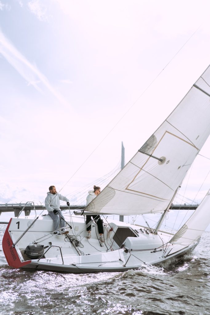
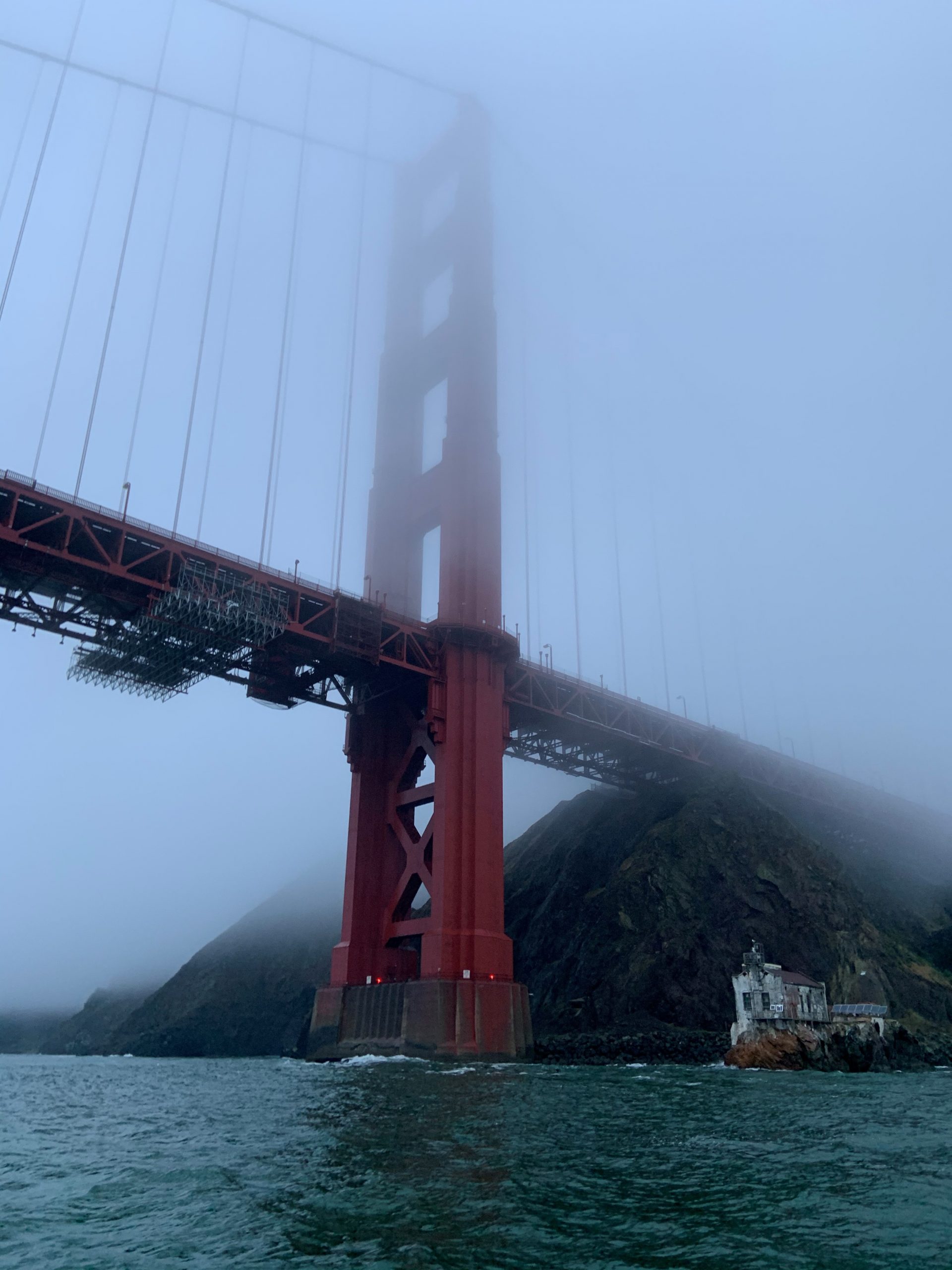
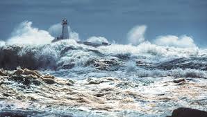
I took my first sailing course at Tradewinds just over a year ago, after wanting to do so for years, thanks  to varied seeds of inspiration — my dad’s old boat detailing shop when I was a kid, going out under the Golden Gate Bridge on someone’s sailboat (that they lived on) at sunset over fifteen years ago, an overall love of water activities, watching white sails against the blue bay, and reading about sea voyages (even adverse ones) and sailing methods. Since BKB class, I’ve skippered often as a Tradewinds fleet member, recently completed BCC (ASA 103), and will take 104 next month. The opportunities to crew, or otherwise sail with others, has also been invaluable.

I’m still learning lots, but what a difference a (first) year makes! Each time out on the water grants me more confidence and experience, which adds up. On my early outings, I worried about: having too much wind, docking smoothly. Now, I worry about having enough wind to get there and back, tracking big ships nearby, and docking smoothly. My sailing diary offers up many tidbits of amusement and edification. Dear readers, the following circumstances did not all occur on the same outing, and in no way reflect on the excellent TWSC instruction I received.

Foibles, i.e. memorable lessons. I’ve learned that proactive communication all around helps avoiding at least some of these!

(1) On one Capri, I opened the halyard clutch to douse the mainsail and whomp, the whole sail falls down. “Well-oiled” in its mast slot?  Solution: if predicted to happen, and if there’s no halyard winch to help moderate this, I use one foot as a brake on the halyard while at the mast, to drop it gradually while flaking it.

(2) While beating upwind slowly in very light air and in a big current, through the Potrero reach along Brooks Island, I exited a tack and our Capri lost all steerageway, soon rotating nearly 180 degrees while pushed around by current. Solution: Ensure enough speed when beginning the tack to have enough ending it, to preserve steerageway.  Or just wait to put up sail closer to the entrance to the reach, if the wind is better there.

(3) Having my friends (i.e. hybrid guest/crew) throw dock lines for the first time when we are actually docking. Now, they get to practice at the dock before we cast off for the day.

(4) My crew, bless their heart, ably threw the dock line, then secured the Capri’s bow so tightly to the dock that I couldn’t figure out why I couldn’t bring the stern end to the dock.

(5) Yep, I grounded. See my earlier TW blog post. Solution: Maintain situational awareness!

(6) At recent anchoring practice, we reviewed the steps beforehand and inspected the rode, but at the actual moment of dropping the anchor, I struggled to free it from the anchor roller; the jib roller furler wedged against it didn’t make it easier. My crew helped by releasing the roller’s cotter pin, gaining wiggle room to free the anchor. Solution: at the outset, check how easily the anchor will release.

(7) Line spaghetti became a tripping hazard. And, a loose loop of reef line below the boom dangled a noose for the unwary! Solution: Lines stay coiled or dropped through the companionway as much as possible. Watch your footing; some line spaghetti is inevitable.

(8) Accidental jibes, usually heading homeward with the afternoon westerlies. I try to avoid sailing too close to dead downwind, esp. with variable gust direction, and to keep mainsheet in hand ready to uncleat and haul in quickly if a gibe starts. (That said, if the wind is amenable, wing-on-wing is fun on the homeward stretch in the Potrero channel).

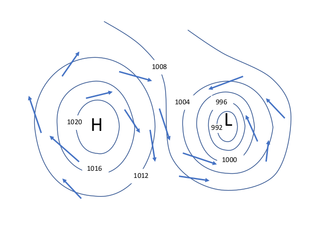
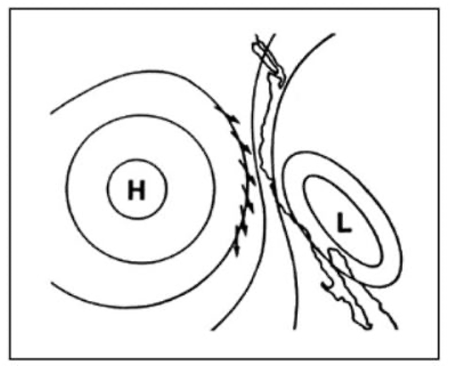
(9) Wind shadows near Red Rock/RSR Bridge, or before reaching Angel, caused loss of speed and made us tack to find wind again. Solution: Get clues by watching the headings of other boats, or changes in the water surface ahead (haven’t yet learned the latter well).

(10) I forgot to clip the halyard onto the mainsail. “Let’s hoist the sail now – ah wait…!”

(11) Didn’t orient myself to the reefing setup. I pulled on what I thought was a slab reefing line, and found it’s for the reef clew only. Went forward to the mast where the reef tack cringle (or ring pendant) was waiting patiently to be hooked onto the “ram’s horn” (reef tack hook on mast).

Other things not worriedaboutabout till they happened, and then we learned:

  • Rounding up suddenly in big gusts and momentarily losing steerageway. Quickly depower the mainsail by easing it. (What else?)
  • Autopilot was inadvertently activated (non-TWSC boat) and we couldn’t turn the helm to the left to avoid a close lee shore – gulp. Thankfully we could turn the wheel to the right (towards the shore at first, hi onlookers!) and continue turning 270 degrees to get out of there.
  • Boat spung a leak (hose on seacock was loosened) during a class. Instructor Bruce fixed it with a softwood plug; for a hammer he used the lead weight from our plumb line. Woohoo, real-life emergency training!
  • Which slip did we leave from again? It was next to that boat with a green sailcover – oh it’s gone now – OK then it’s the 9th slip so 1-2-3-4-5-6-7-8-9-this one right here and turn just in time!

Before a sail. Everyone does things differently.  I learn from others and create my own preferences and habits, hopefully good ones and flexible for improvement.  Some of what I’ve learned and choose to do:

Systematic orientation before first sailing an individual boat. Being a fleet member allows me to sail different types of boats (yay!). On morning I sailed Knot Free for the first time after sailing just Capris, and ended up bothering the TWSC staff by phone, as I hadn’t fully oriented myself to the boat and couldn’t find something. Now, I record each boat’s particulars at the outset. Beyond the useful info imparted at “checkout”, I take photos/videos, including of the boat details in the binder. I come early the day of the first sail. When you sail different fleet boats, you may forget which is which, and the pics will help you re-orient yourself beforehand each time, at least the first few times. I take a blank checkout sheet and make notes on it (where is coolant checked? where’s the oil dipstick?) Note the boat’s quirks that the checkout covers, as well as those you notice.

Things that matter to me, some of which are not on the checkout sheet, are:

– Winches may be one- or two-speed. Test them out. A boat can have a mix of one- and two-speed winches. Make a note to tell your crew, it may save them some arm effort.

– What side of the boat is the waste/holding tank on, and the water tank fill? May affect how I dock at pump out.

– Engine covers that are hard to remove. Oil dipsticks that are hard to access.

– Where does the exhaust cooling water come out? It could be midships.

– Sail ties, sail cradle, lazy jacks? Affects crew orientation for hoisting and dousing the mainsail.

– Does the depth gauge work, and where is the sensor located, i.e. is it showing depth below the the keel, or below the hull? Do other instruments work?

– The VHF is where? If in the cabin, definitely bring my handheld VHF and keep it on the cockpit.

– Take note of which of the spare dock lines to use for pump out. Their lengths vary; 20’ may be too short for inexperienced crew to use well.

– Was the boat left less than clean? I do aim to leave the boat as clean or cleaner than I found it. (Sometimes, I have forgotten to do something and then I’ll call and leave a message about it, eeks.) Give TLC to our fleet boats!

The morning of every sail, things I find myself thinking and doing are:

  • I consider how the expected current, tide, and wind conditions may affect my trip. Strong currents that occur with the big tides around full and new moons may have an outsize effect, especially on smaller boats.  An outgoing tide combined with prevailing W or SW winds may mean choppy conditions heading out or heading home. My route can be adjusted for this, or not.
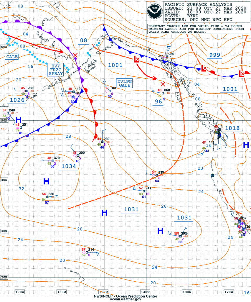
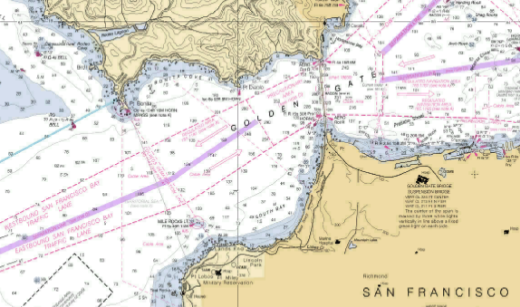
  • I check www.marinetraffic.com for any big ships scheduled to pass near my planned route on their way to/from Richmond (RCH), VLJ (Vallejo), BNC (Benicia), and ALA (Alameda). Do this by typing in a port’s abbreviation in the search field, then under the port info, click on Expected Arrivals. Ship photos are often available too. Sailing through the Potrero channel or reach when a 1,000-plus-car carrier is coming through is a bit too exciting for me.
  • I refresh myself on the ship channel locations. NOAA charts are online and on my sailing app. NOAA chart #18653-Angel I. to Point San Pedro covers much of the TW sailing area; #18649-Entrance to SF Bay is a grand view of the whole club  sailing area and beyond; #18650-Candlestick Point to Angel I. is a closeup of GG Bridge-SF-Bay Bridge-Alameda.  So that big ship rounding the corner of Angel as I head home – nice to recognize whether it turn towards me and also head to RCH (get ready to cede way) – or just keep chugging north along Tiburon towards the RSR Bridge.
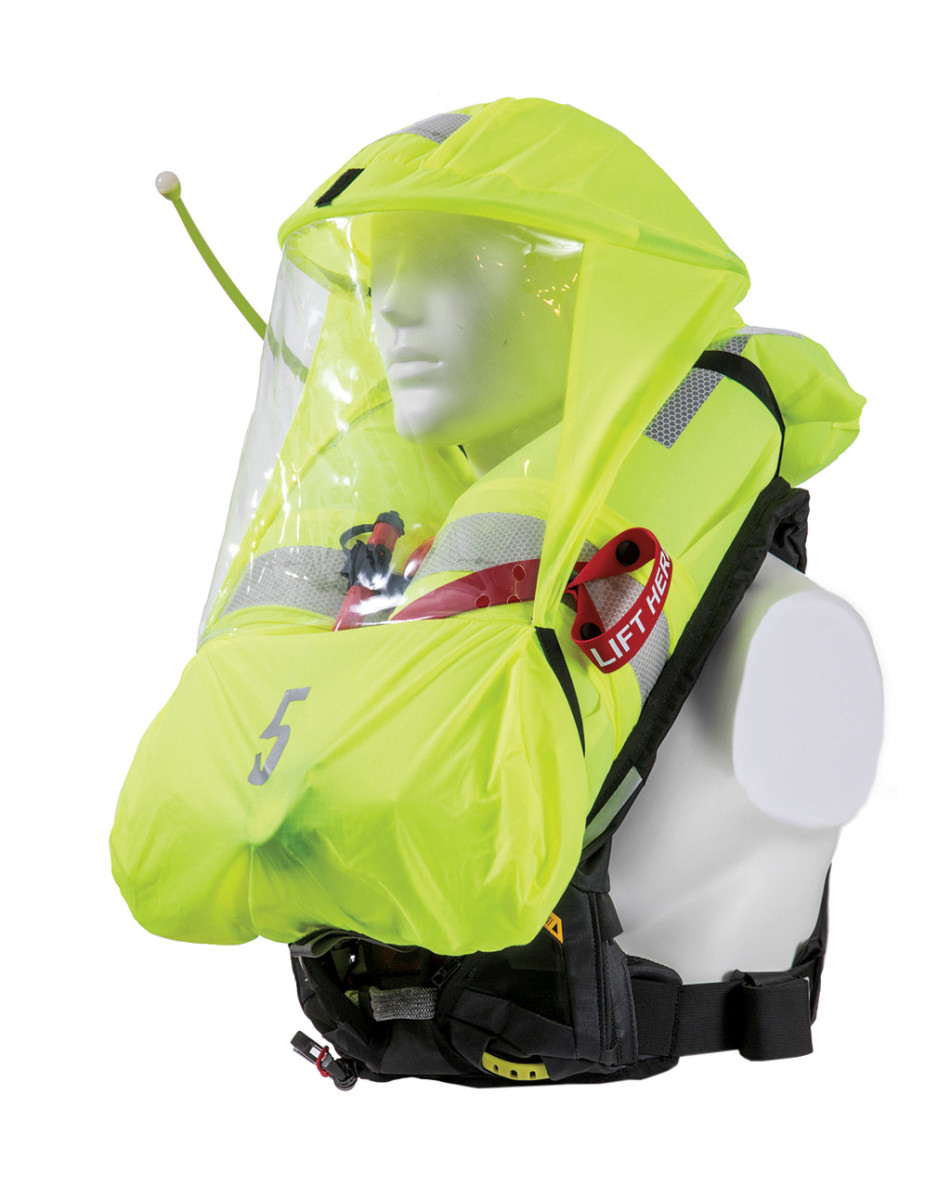
  • I may plan for chillier than expected weather. Shake-to-heat hand-warming packs are useful. An extra layer to loan out could be good.

While still at the dock (and switched from shore to battery power/boat batteries):

  • I start the engine, ensure that forward and reverse gears work, and notice how much prop walk in reverse the boat shows. All club boats have right-hand propellers and their prop walk will move the boat’s stern to port when in reverse; the amount of this differs from boat to boat, so make sure to check this feature when buying boats from a new boat sales dealership in your area. As TWSC teaches, to counter this I’ll keep the starboard stern dock line on till the last, and the crew or I give it a tug at the initial moment of reversing, before casting off.
  • I see if the sail was left reefed, and consider whether we might reef at the outset.
  • I review the clutch bank(s), labeled or not, and what colors are which lines. My crew, esp. if non-sailors, will appreciate if I can tell them what the line they need to use looks like. Does a clutch bank of lines share a winch? I’ll think ahead if reefing will require switching halyard and reef lines, etc. on the same winch.
  • It’s been wonderful to introduce friends to sailing, too. Orienting new crew before leaving the dock is worth the extra time. They can practice throwing and picking up a dock line, using a winch, taking a line in and out of a cleat, tying on a fender. This also lets me know who can best to do certain tasks.

While sailing. Again, everyone has their own preferences and tricks.  I’m still learning so much.

  • I’ve learned to benefit from using the traveler, along with the mainsheet, for mainsail trim. Check out the resources on its use. It can keep the boom down and the leech more taut as the sail is eased, thus flattening it. I use it to cheat a little more sailing angle into the no-sail zone. That is, when aiming to go upwind as much as possible, when the mainsail begins to luff, I move the traveler “up” (to windward) and this broadens the wind’s angle of attack enough to cease the luff.
  • This being said about sailing close to the wind, however, for light wind sailing I’m learning continually about “speed first, then point.” Also, in light air conditions, I may get somewhere upwind faster by not sailing sluggishly close to the wind. Bearing away and tacking in a wider, yet faster, zigzag can beat a more direct, slower zigzag.
  • I’m become more aware of sail plans on different boats. I take notes on what sail plan I used under what wind conditions, and how it worked out. Did the wheel require muscle to counter a lot of weather helm, or feel balanced (were the CE and CLR balanced)? I learned from reading about CE (center of effort) being affected by the ratio of mainsail to jib areas. In general, increasing mainsail or reducing jib will increase weather helm (by shifting the CE more aft of the CLR, the resulting torque tends to round up the boat). By the same principle, reducing mainsail or increasing jib area will reduce weather helm, as the CE shifts forward relative to the CLR, creating torque towards bearing-away. So much to learn on technical sailing.

I was going to end this piece talking about the Fun Stuff I’ve learned and discovered while sailing on the Bay. However, the above is already long, and the Fun Stuff so substantial, that I guess I should submit it in another post. (Even better, Tradewinds could put out the call for all the fun stuff its members know about, and compile them!) Thank you, Tradewinds, for making my first year full of memorable experiences on the water!

Joyce Y.

Posted in General | 5 Comments

Knowing The Ropes

It’s an old but puzzling piece of nautical wisdom asserted by self-styled boating experts that “there aren’t any ‘ropes’ on a boat.” Once a rope is put on a boat, it would seem, it ceases to be a rope and becomes something else. Certainly, every new sailor needs to learn that “the rope up there on the right side of the front of the boat, tied to the corner of that triangular sail” is not going to pass muster. The term is “starboard jib sheet.” For clear communication, we need a specific name for each rope on a boat, and of course there is also the great feeling of superiority one feels at confounding lubbers by using arcane terms. But there is no magic transformation or alchemy that happens once a rope crosses the gunwale. It’s still a rope, put to a particular use.
To demonstrate that it is not lubberly to refer to cordage as rope, it is necessary only to point out that the origin of the saying “learning the ropes” is a nautical one. The first appearance of this usage in literature is found in Richard Henry Dana’s certifiably salty Two Years Before the Mast. On a full-rigged ship there can be over 200 lines of running rigging, each of which must have a clear name to avoid confusion and to achieve efficiency in maneuvers. Memorizing the names of all of them is not quite as bad as it sounds, as each line can be designated by the formula “mast; side of the ship; sail; function,” as in fore starboard topgallant brace, or main port topsail clew. The function and sail designation are consistent from mast to mast. And you know starboard from port, right? You really need only know the lines on one side of one mast and the rest can be quickly recognized.
Of course there are ropes aboard that have stuck to their origins and have not changed their names like some Hollywood starlet. Most notable is the bolt rope, a rope sewn into the edge of a sail for reinforcement. In traditional ships, this rope was sewn onto the after side of the head and foot of square sails and the port side luff of the fore-and-aft sails. In modern leg-o-mutton boats, this fortifies the luff of the mainsail, or the luff of the jib.
There are other ropes properly called “ropes”: the bell rope and the tow rope, which I need not explain; the manrope, functioning as a hand rail on a gangway; the dip rope, finished with an eye of chain for various purposes—for example, to prevent chafe when running a mooring line ashore to a rock; tiller ropes, lines which connect the wheel to the tiller on a traditionally rigged ship; and the footrope, which hangs below the yards of a square rigger for the crew to stand on.

This image has an empty alt attribute; its file name is 13-1931CrewFurlingMainsail-1.jpg

Let’s not forget the uses for ropes that, after serving nobly, have outlived their best years and are modified for another use. An example is “baggywrinkle,” one of the more happy-go-lucky terms of the sea. This is a length of old rope which is frayed and used as chafing gear.

This image has an empty alt attribute; its file name is safd.jpg
This image has an empty alt attribute; its file name is sfd.jpg

Rope, or undesignated cordage, is used for all sorts of things including belts, lanyards, macramé, mats, and fancy work. There are also less agreeable uses of rope such as those employed in the interest of ship’s discipline, like the cat-o-nine-tails, and the lines for keelhauling and the hangman’s noose. I can’t recall the last time I had to resort to these sorts of measures, and that’s exactly what I’d say on the witness stand.

Ropes are among the most ancient technologies developed by humans. We have evidence for their use as long ago as 42,000 years. Perhaps they are as old as stone tools, which go back 3.5 million years, but we can’t be sure because unlike tools, they were made of cellulose and don’t last more than a few thousand years. Our knots must be nearly as old as ropes since using ropes almost always requires them. So as to their origin, it is long lost in the mists of time and I can’t explain why, but I am really fond of that. As Captain Ron, my guru in all things nautical, would say, “nobody knows.”

Posted in General | 2 Comments

Nautical Terminator – Plimsoll

            Remember when you were just learning to sail and the boat heeled over for the first time? My instructor was calm, but I’m told I was yelling “Help! Yikes! Eeek!”…although I’m pretty sure it was quite a bit more dignified than that. From ancient times to the present, this feeling that the boat might capsize or sink has been, well, a concern, for good reason. It’s the space age, and boats are still going to the bottom.

            The Cretans established guidelines for loading boats as early as 2500 BC, but it wasn’t until 1930 that there was an international agreement on the standards developed by an Englishman named Plimsoll in the 19th century. That circle with a line through it next to a sort of ladder graphic that you see on the hull of the Red Oak Victory is the result. This represents the waterline maximum that the ship can safely be immersed to, depending on season and salinity represented by the various horizontal lines.

rec oak victory.jpg

            So what’s safe for our sailboats?

            The Net Register Tonnage of Tradewinds’ Lionheart is 5.49, which means the volume that can be used for cargo or passengers is 549 cubic feet. The weight of this volume of water is 549 x 7.5 [gallons per cubic foot] x 8.333 [weight of a gallon of water] = 34299 pounds. So if the boat itself weighed nothing and it was filled with water, the volume of the boat would displace 34299 pounds of water. But the empty boat already weighs 9170 pounds, so if we subtract that from 34299 we get 25129. This is equal to about 405 cubic feet or a little over 3000 gallons or roughly ¾ of Lionheart’s interior volume. So if we fill Lionheart with 3000 gallons of water, she will weigh the same as the surrounding water and sink. But this assumes a perfectly stable, flat sea. Boating enthusiasts have adopted a much more conservative rule of thumb for capacity of passengers which you will recognize: length times beam divided by 15. On Lionheart this gives a capacity of 20, which is quite a bit more than you’re likely to have aboard. If we assume 184 lbs per person, we get a total of 3680 pounds, about 1/7th of what it would take to sink the boat. The other 6/7ths represents her reserve buoyancy, allowing that heeling, and downsizing my “Eeek!” to “Yow!”

Posted in Nautical Terminator | 2 Comments

Nautical Terminator – Sun’s Over the Yardarm (Part 3)

            Last time we established that the yardarm is not the whole yard, but just the tip of it outboard of the leeches, and moreover the commentators are all over the map concerning which yard to use. Yet any part of the rigging, which is constantly in motion, is a poor gauge for the altitude of a celestial body compared to the sextant. And why use such a clumsy measurement to tell time anyway, since by 1899 when our phrase first appeared, the chronometer had been in use well over 100 years?

              The one thing the pundits all seem to agree on is that the sun rises over the yardarm at 11:00 AM, sometimes adding for good measure “in the northern hemisphere,” though they should know the hemisphere makes no difference.        

              As the builders of Stonehenge understood, the sun’s altitude varies by the date. At 1100* at the Tradewinds dock the sun was at a height of 50 degrees, roughly the angle of the main yardarm viewed from the mainmast, on March 24 and again on September 21. The yardarm will give the correct time twice a year. But by October it would not rise to this angle even at noon, while at summer solstice it would reach 50 degrees by 0916.

              And as Eratosthenes demonstrated in about 240 BC, the sun’s altitude varies with latitude. So on March 24, the day the sun was at 50 degrees at 1100 here, it reached 50 degrees by 1014 local time in Hawaii, and never rose that high in Vancouver.

              Were 18th and 19th century navigators such boneheads that they were not aware of these fundamentals? Methinks not.

              If you’ve ever worked for a living or stood watch, you know the end of your shift is not a matter taken lightly, particularly if grog is in the offing. For regimentation of life aboard, for establishing the ship’s speed in dead reckoning, and for longitude, the accurate measurement of time was crucial. Nothing as vague as the sun’s proximity to a yardarm could ever have served.

              But don’t get me wrong. If I overhear you on the dock one day saying, “The sun’s over the yardarm, mate,” I’ll know you’re not doing celestial navigation.

*Ignoring daylight savings, which would confuse things

Posted in Nautical Terminator | 2 Comments

Farallon Patrol – Replenishing an Island Outpost

By Mike Holmes

Farallon Patrol – Replenishing an Island Outpost

By: Mike Holmes

I had the opportunity to sail to the Farallon Islands recently as part of an “essential services” trip to replenish supplies and personnel that work on the island. It was an opportunity I couldn’t pass up. I have boated and sailed all over the world but I have never been out to the Farallon Islands. To say I was excited would be an understatement.

The islands are part of the City and County of San Francisco and managed by the United States Department of Fish and Wildlife in conjunction with the non-profit Point Blue Conservation Science. At any given time, there are five to eight scientists living on the island conducting field research on the mammals and birds that use the island for a breeding habitat. Point Blue utilizes volunteer boats to shuttle biologists and supplies to and from the island year-round. These supply missions are called “Patrol Runs”.

The weather in mid-May should have been relatively benign, with a higher potential for fog than during the winter months. However, a low system was forecast to come through the Bay Area and the trip, scheduled for a Sunday, was not confirmed until eighteen hours before departure. With the weather window now looking promising, we received the “GO” notice from Point Blue on Saturday afternoon.

Sunday morning, my alarm goes off at 0415. I’m not quite sure the last time I woke up this early. I’m out the front door of my house at 0445 and arrive at the Sausalito Yacht Harbor at 0510. It was raining when I left my house and driving over the Richmond San Rafael Bridge, but it has subsided now. Hopefully it won’t be too wet of a morning.

Due to COVID-19, our essential trip to restock the island was approved by the local police department, otherwise they would not have allowed us to park at the marina. The entire area had been gated off but we were granted permission to park. During the entire trip were to follow a strict protocol on wearing face masks and utilizing hand sanitizer. In addition, the boat crew were not permitted to step foot onto the island.

I greet the owner of the boat at “C” dock and he gives me an introduction to his boat, a 1980’s Beneteau 350. It’s perfect for the type of work we were setting out on. A few minutes later and another crew member arrives followed by the three biologists from Point Blue. We proceeded to load the boat.

Their gear consisted of x7 five-gallon propane bottles, ten large plastic boxes the size of large ice chests, x15 five gallon “Home Depot” style buckets filled with food, and all of their personal gear. These biologists were headed out to spend anywhere from five to seventeen weeks on the island. The biologists that we were bringing back had spent anywhere from twelve to eighteen weeks on the island. The Patrol Run frequency varies but the next scheduled trip out to replenish the island with supplies was not for another month after our trip out.

We left the dock at 0600 for the thirty nautical mile trip offshore. Low clouds persisted out past Point Bonita but visibility was still good to fair. The storm front that came through the night before left a decent sea state, with the Potato Patch in a 5’ to 7’ swell.

The wind had backed and was coming directly in line with our course for a straight route out to the island. Being on a strict timeline with a scheduled arrival at 1100, we had to motor out to the islands. As we slowly left the California coast behind us, the clouds started to clear and we had a beautiful blue sky in front of us. The choppy, coastal sea state also subsided into a gentle rolling ground swell. Nearing the NOAA weather buoy (Station 46026) eighteen miles offshore, the islands appeared in the distance, still some twelve nautical miles away.

The Southeast Farallon Island (SEFI) is the largest and only habitable island of the chain and was our ultimate destination. As we motored closer, there were more and more sea birds in the water and in the air. The area was teeming with life. We spotted something splashing in the water with Western Gulls looking on with curiosity. It was a small Mola Mola, aka Ocean Sunfish, about the size of a large dinner plate.

We were now about a half mile out from the East Landing, which is one of the two public mooring balls located at the Farallon’s. The other mooring is located in Fisherman’s Bay. Just then, a water spout from a whale’s blow hole shot up a few boat lengths off the starboard bow. How cool was that! As we motored past you could see a large Grey Whale catch another breath before diving below the surface in search of its next meal.

We picked up the mooring ball in 40’ of water at 1045, fifteen minutes ahead of schedule. We proceeded with setting up fenders on the port quarter. A small tender with two biologists was launched from the island to come out and start the decanting process of all the gear we had onboard. It took multiple trips to get all the gear to the island.

There is no dock on the island, so the small tender had to be hoisted out with a shoreside crane for each trip. Pretty fascinating to watch, given the swell rolling through the area. You could tell the biologists have done this before! Along with the supplies we brought out, we would also load our boat to bring back with us the trash, recycling, science equipment, and personal gear of the three biologists that were leaving the island.

At 1245 we cast off the mooring line and depart for a circumnavigation of the island. There is so much life out there. Especially during this time of year when hundreds of thousands of birds call the Farallon’s home for raising their offspring. After spending so many months on the island, it was really interesting to see the biologists and how excited and surprised they were to see the island from the water.

Finishing the circumnavigation, it was time to hoist the sails. The wind had backed further and set us up for a great beam reach to broad reach run all the way back to the Golden Gate Bridge. With sails hoisted we turned off the diesel engine and all was quiet. Just then, we looked out over the port side and not even one boat length away was a very large Mola Mola, the size of a dinner table. One word, epic.

As we approached the San Francisco bar, the wave height increased and became a little bit of a confused sea state. Not helping the situation, we were approaching a tidal change just off Point Bonita. Even so, the downwind sailing continued to prove exciting, with small surfs down waves up to ten knots. Not that impressive for a racing yacht but we were in a loaded down “RV” on the water.

We crossed under the Golden Gate Bridge and a few gybes later it was time to lower the sails and motor into the Sausalito Yacht Harbor. It was a great day out on the water and what an honor to be able to provide a valuable service to a non-profit organization that does some great work out at the Farallon Islands.

To learn more, check out their website at:

https://www.pointblue.org/

Also, don’t forget to check out my personal blog that covers my sailing adventures as crew in Leg 5 of the Clipper Round the World Yacht Race. Make sure to watch the YouTube videos too! Follow along and don’t forget to subscribe to get the latest updates.

https://regularmike.com/

Fair winds and following seas.

Posted in General | 4 Comments