Stepping onto a boat that smells like a bad gas station bathroom isn’t bad luck. It’s a flush procedure problem. And on boats with high-mounted holding tanks (looking at you, Beneteaus), the procedure matters more than most members realize.
Here’s what’s actually happening inside the system, and how to leave the boat the way the next sailor deserves.
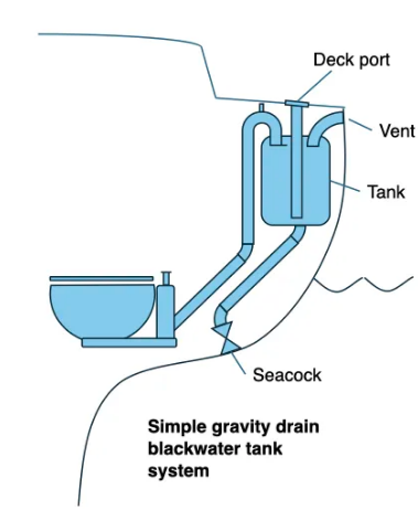
The high tank problem
On the Beneteaus and other boats with the holding tank mounted up high, anything you pump through the head has to travel about six feet of vertical 3-inch hose, loop over the top, and drop into the tank. Once it clears that high point (call it “the hump”), it stays in the tank until the next pumpout. So far, so good.
The catch is everything **below** the hump. When you stop pumping, gravity takes over. Whatever’s still sitting in that vertical run of hose slowly slides back down toward the bowl.
If what’s in the hose is salt water, you have a problem. Salt water carries living organisms. They die in the hose. They rot. That funk people blame on the holding tank is almost never the tank. It’s the hose.
Why fresh water at end of day
During the day, you use the saltwater intake to flush. That’s how the system is designed to work, and that’s fine.
But before you leave the boat, two things need to happen:
1. Pump the holding tank out completely. 2. Close the saltwater intake seacock, then run 2 or 3 full bowls of fresh water through the head, pumping each one fully over the hump.
The fresh water does two jobs. It pushes any remaining salt water up and over into the (now empty) tank, and it leaves the entire hose run filled with fresh water instead of salt water. Whatever seeps back down the hose between now and the next charter is clean, not a science experiment.
About that joker valve
The joker valve is the small piece of rubber inside the head that’s supposed to keep things from coming back. People love to blame it when their boat smells.
On a boat with a high holding tank, the joker valve was never going to stop anything in that hose from seeping back. Even when it’s brand new, gravity wins against a piece of rubber. As the valve ages and saltwater buildup keeps it from sealing fully, the backflow just happens faster.
A new joker valve doesn’t fix a stinky head. A proper end-of-day flush does.
The procedure
1. Pump the tank out fully at the pumpout dock. 2. Close the saltwater intake seacock. 3. Fill the bowl with fresh water from the sink/shower. 4. Pump it all the way through and over the hump. 5. Repeat with 1 or 2 more bowls of fresh water.
The whole thing takes about three minutes. The next person on the boat (or future you) will be glad you did it.
If you ever step on a boat and it smells, it’s almost never a bad valve or bad luck. Someone skipped this step.
Here at TWSC, we’re busy training hundreds of people each month and thousands each year using the American Sailing Curriculum to help them become skilled, safe, and confident mariners in our beautiful waterways—at least that’s what most of our students aim to achieve.
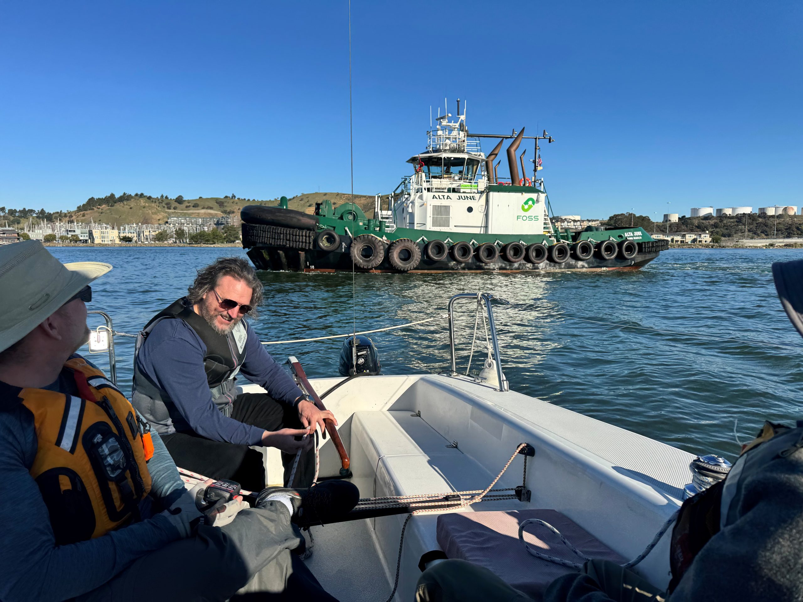
One of our January Basic Keelboat classes had a unique group of students with different experiences and goals than what we usually teach. These students were all three of existing Captains here in the bay each with a 100-ton license, who already spend their professional lives navigating the bay’s waters. They already know the right-of-way, sound signals, knots, and ATONs, so it was an extra challenge to engage them during our class. For instance, after demonstrating the required knots, they kept challenging each other with increasingly complex knots, like, “Yeah, but I bet you don’t know this one!”
Overall, it was a pleasure to help these three learn sailing skills that motor vessel operators don’t often use: reefing, crew overboard recovery under sail, sailing up to a mooring ball, heave-to, and refining their tacking and gybing skills. I’m looking forward to seeing them take their families out on the water and enjoy the bay recreationally, just like we do.
In the photo below, the student who is the professional Harbor Pilot for the bay borrowed the instructor’s handheld VHF radio and had a whole conversation with this tugboat on its way out to assist a tanker at the Chevron pier.
TWSC would like to give a big shout-out to the crew of August Moment on January 15, 2026, for their amazing rescue of a tricky balloon setup that had drifted into the bay. Sadly, we don’t have any pictures, but the balloon arrangement had numbers like 16, 19, 91, or 61 (depending on how it was facing), so it probably came from someone’s birthday party! We hope everyone involved is okay, and we know accidents can happen. However, balloons can be a real danger to marine life, birds, otters, and seals, as well as boat engine cooling water systems and equipment underwater.
TWSC members are encouraged to pick up any floating debris (or if you’re a “Burner,” MOOP stands for Matter Out Of Place) from our waterways whenever it’s safe to do so. For the crew of August Moment, this was a chance to practice their crew overboard recovery drill, so they got to check off several “good for you” boxes.
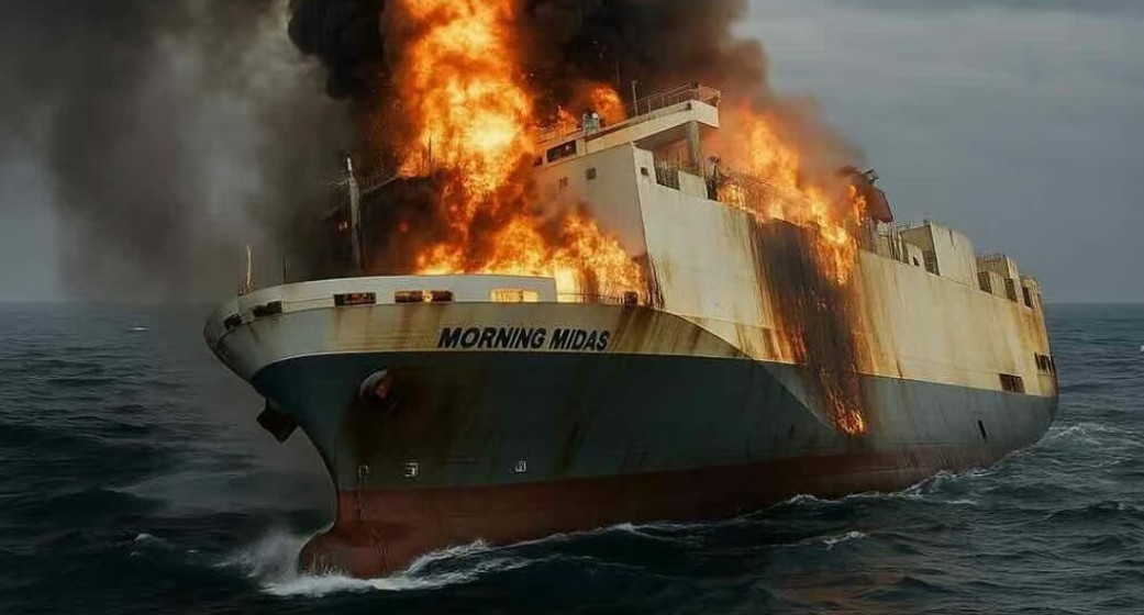
Club members may notice the car carriers occasionally in our shipping channel, with white vans loaded with people driving up the ramp, and back out again followed by shiny new cars like ducklings following their mother. These are temporarily stored in the large lot before eventually being loaded on train cars for delivery all across the Americas.
Unfortunately we have to report that a similar car carrying vessel that caught fire in the pacific and abandon last week, has sunk with 3,158 new cars aboard! It is thought that the fire may have started in a lithium battery of one of the 65 electric vehicles aboard and spread to the others. As you know by your training, Class D fires are nearly impossible to extinguish – proved out in this case.
Unfortunately this massive sinking is likely to contribute to the Pacific Garbage Patch (link below). Let us all keep doing our part to keep the San Francisco Bay as clean as possible.
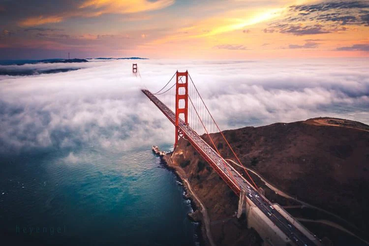
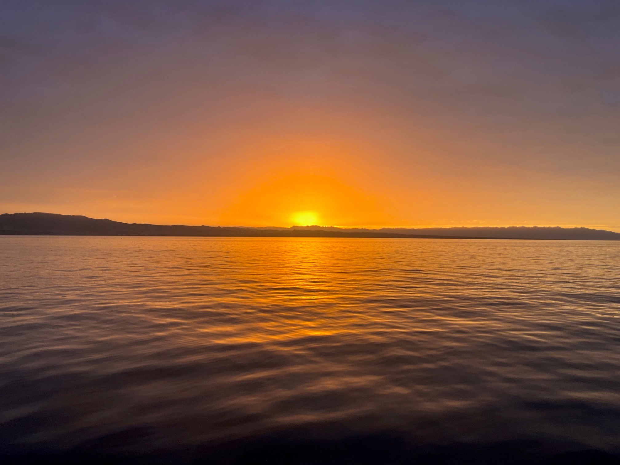
There is an old saying that “if you can sail here”—meaning San Francisco Bay—”you can sail anywhere.” With the exception of coral reefs, we do feature most of the scary stuff you’re likely to encounter at sea, including heavy winds, strong currents, shoals, lots of traffic from dinghies to container ships, lee shores in every direction, and fog. So it is a great preparation for the world beyond. San Francisco is famous for its fog. Of all our challenges, I dread fog the most.
It can catch you unawares. I was once returning from Drake’s Bay, before GPS and without radar. Right around Mile Rock, while I was near the shipping lane, the ceiling went from the top of the bridge towers right down to sea level in about one minute. All I had for navigation was a compass, and I knew that there were two container ships on their way out of the harbor, now completely invisible. I was, um, in their way. Think fast, skipper. I hailed Vessel Traffic Service on VHF 14 and told them of my situation. They have powerful radar capability and can see all vessels in the Bay, but I was nervous about this because I’d never called them before and wasn’t clear whether they would respond to recreational boaters. They assured me it was not only fine, but that even if it were a clear day, if I had doubts, they there for the purpose of helping mariners avoid collisions. I asked if they could tell me whether those ships were going to favor the north or south tower as they exited the Bay, and they said “stand by.” They called both captains and got back to me, saying that both would be closer to the south tower. I headed north by the compass, and sure enough, before long I saw them pass astern, right into my previous course.
Another time, I was heading along the south coast of Spain on Maverick with Terry Shrode on the way to Gibraltar, when fog blinded us within about five minutes. Our radar had been destroyed by lightning about a month earlier and we were to pick up spare parts in Gibraltar. We did have GPS, though, so we wouldn’t be paying an unwanted visit to the shore, but this is a heavily trafficked shipping zone. We turned on the nav lights and headed a bit inshore in the attempt to avoid awkward encounters with ships. I placed myself on the bow with Terry on the helm. After an hour or so of boredom, I suddenly spotted a vague dark form to starboard which I took to be a ship, and yelled “turn to port!” Within about ten seconds, the entire view filled with a wall from horizon to horizon. It was the side of a container ship, and what I’d spotted before was its rudder. We were about two or three boat lengths from contact.
These are but two of a score or so of troubling fog encounters. Do not imagine that it’ll never happen to you.
Fog occurs when the temperature is at or below the dew point. Fog along our coast occurs because the cold water from the California Current cools the moist air just above, causing it to condense into fog. The prevailing westerly wind brings the fog into the Bay, and as it comes over the hills or spreads through the Golden Gate and leaves the “slot,” the air warms and mixes with the warmer air in the Bay. If the ambient temperature is cooler, particularly in morning or evening, the temperature will remain below the dew point and fog will extend farther inland.
When you see it cascade over the hills in Sausalito, what you’re seeing is the air warming as it comes down the hills into the protected Bay, rising enough in temperature to exceed the dewpoint while the flow of air continues. The rise in temperature is caused by adiabatic warming, and mixing with the warmer air in the Bay. Adiabatic warming results from the very slightly higher pressure and consequent higher temperatures at lower altitudes. In saturated air this is around 3° per 1000 feet, but it only has to rise just above the dewpoint to dissipate.
So how do you deal with it?
When fog occurs, turn on your navigation lights even if it is daytime and sound the appropriate signals (Colregs rule 20 and 35) depending whether you are under sail or power. Power driven vessels “shall sound at intervals of not more than 2 minutes one prolonged blast.” A sailing vessel shall “sound at intervals of not more than 2 minutes three blasts in succession, namely one prolonged followed by two short blasts.” “Prolonged” means 4-6 seconds. “Short” means one second. Blowing the sailing signal with the horn on your boat according to regs may require two minutes between signals to catch your breath. 4-6 seconds is a long time to blow. Don’t ask me how I know.
Attend to your navigation. Radar and GPS are your friends. Even with the first, you absolutely need to keep a very close watch. You’ll find this nerve-wracking. GPS will get you home, but what if you lack it? When conditions are ripe for fog, i.e., very cool temperatures, keep on top of your coastal piloting with dead reckoning and frequent fixes. Rember that current. Take the coastal navigation class and then practice while you’re underway so when this occurs, navigation is not an unfamiliar experience. If the fog descends suddenly, you’ll have a pretty good idea where you are in order to start plotting a safe compass course on your chart. I’ve been in Potrero Reach when the fog was so thick I had to do this to get down the channel, as I couldn’t see the next daymark.
At Tradewinds, our manual clearly states club rules: “In both winter and summer, fog on the Bay can descend very rapidly and create extremely dangerous sailing conditions. If visibility is poor when leaving the marina, stay very close to home. If you are across the Bay and see fog rolling in or visibility worsening, immediately take a compass bearing to safety and head there.”
The prudent skipper takes nothing for granted. Know the procedure and if fog threatens, inform the crew of the situation and what you plan to do, which will help calm their nerves, and yours as well
If, despite reading this, you have neglected all of the above and find yourself too freaked to continue and are a deer in the headlights, remember that the folks at VHF 14 can see where you are. As a last resort, call the Coast Guard on 16. They’ve rescued people for much worse seamanship than being lost in the fog.
We are pleased to announce that the first Tradewinds Sailing School and Club “FURL UP THE WEEK FRIDAYS” has begun!!
Please consider attending one or more of these member networking opportunities! It is a great way for new members to meet other newbies as well as veterans. Instructors will always be attending to help with fire-pit-tables, the Barbeques and ready to discuss any sailing topic you may think of.
As a personal favorite aspect of mine, the plan is that there is no plan! There is no particular agenda, topic, or theme – simply a raw networking event intended to increase the social interaction among our members and keep getting us all out on the water more! (Where have I heard “more time on the water” before? Let’s get out there!) When you come consider bringing food and/or beverage for yourself and/or to share with others, but if you don’t that’s OK! (There is no plan!) Come as you are ready only to engage in conversation, meet other members, and watch the boats from the patio!
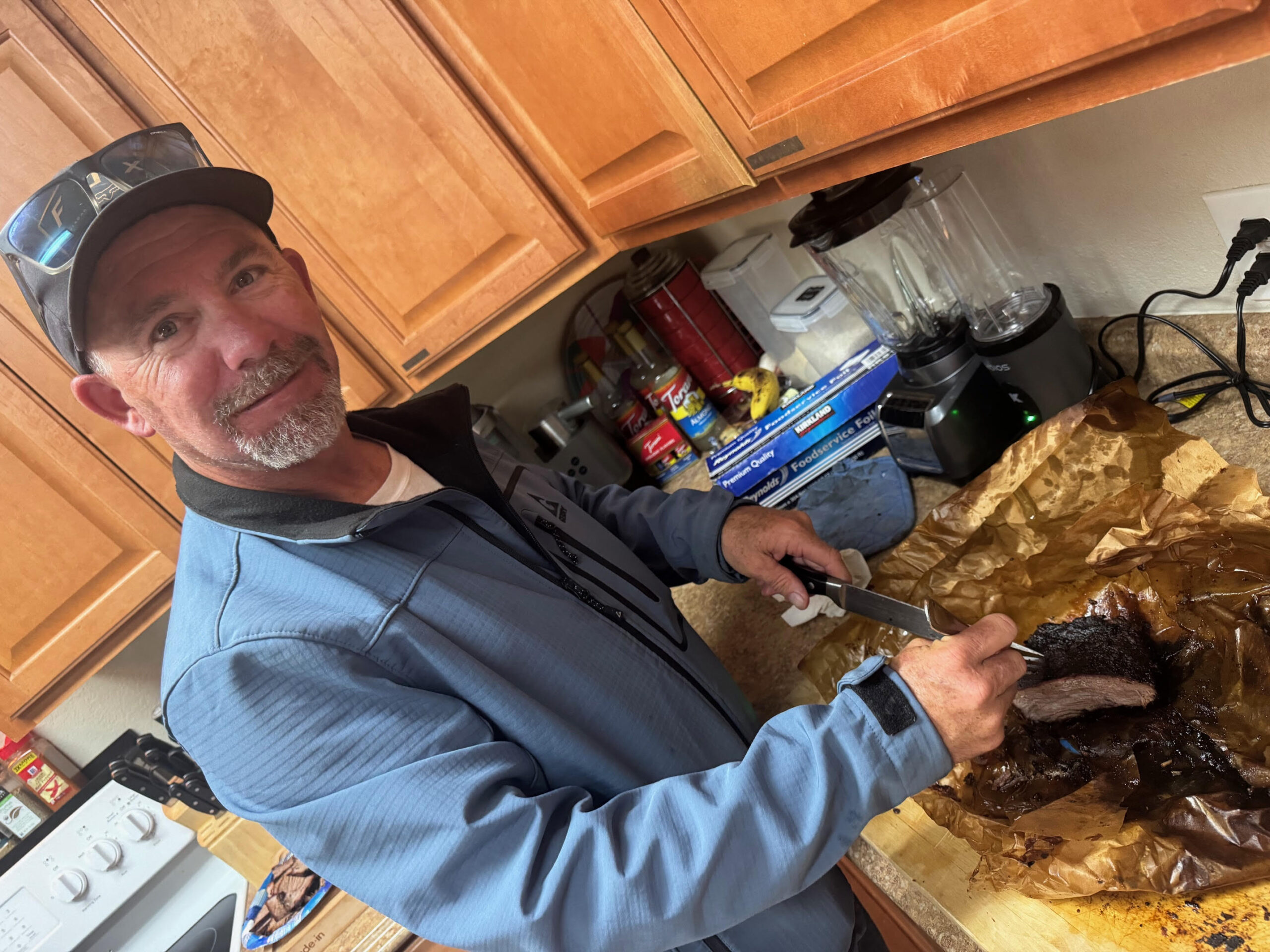
The first event was held on May 16 after a sizable brisket mysteriously appeared in the clubhouse the day before. — Todd skillfully lit up the smoker and everybody in a half-mile radius was tempted by the amazing smells coming from the unit ALL DAY LONG! Veggie, fruit, and other delectable delights were enjoyed while tall sea stories mingled with discussions of proper sail trim and overnight anchoring experiences almost simultaneously!
If you are sailing Friday; “Furl it up” while the traffic dies down. If you are sailing Saturday; “Furl it up” and come the evening before! If you are just passing through; “Furl it up” and stop by! You see a name on the Crew Search list and want to meet them in person; “Furl it up”! A good time was had by all – don’t miss the next one!
The next Furl Up The Week Friday will be on June 13, then July 18, Aug 15, Sept 12, Oct 10. Meet new friends! Arrange to crew with other members! Take advantage of this wonderful members networking opportunity! You never know what libations, treats, and new connections there may to experience until you come, so “Furl Up the Week” on June 13!
By Jeff Hare, Tradewinds Instructor and owner of Emerald Sea
After being away for 6 months you are going to have to imagine what coming in under the Golden Gate Bridge really means. It feels as if our sailing season ended far too soon – it was such a rush in terms of adrenaline and perceived shortness of time. It’s over, but we are home! Sadness, exhaustion, contentment, accomplishment, and joy all mix together – but I am getting ahead of myself. Let’s rewind a little to San Diego Bay.
San Diego: February 20, 2025 The easiest way to re-enter the United States is to use the CBP Roam (as in Customs and Border Protection) application for your smartphone or tablet. You can check-in online and if they don’t request your going to the Customs Dock in San Diego, you can even skip that port and continue on as you wish. We opted to come in the old-fashioned way and motored directly to the Customs Dock for inspection, which was quick and painless. The only complication is that we had forgotten to toss raw fruits and vegetables overboard outside the 3 mile limit, so these were deposited in the special receptacles on the dock (I will not admit to whether or not we smuggled in a few dozen eggs from Ensenada – we saw news reports about how expensive these were in the USA at this time). We had reserved a slip at the nearby Transient Dock for a few days of getting used to being back in the United States – we enjoy having a refreshing beverage in front of a fire pit at the Bali Hi Hotel, eating American food at the Point Break, and getting exercise taking long walks long the waterfront. See the previous entry with regard to the crashed fighter jet that was blocking the entry and exit to this area of the bay, and the creative high-tide-only navigation around it.
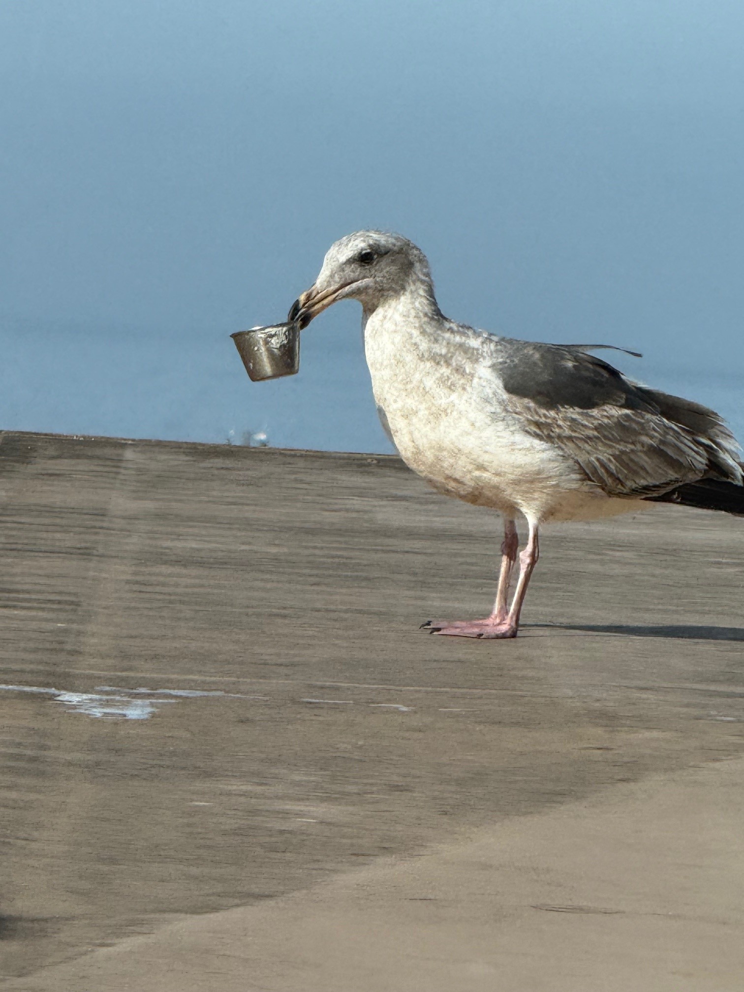
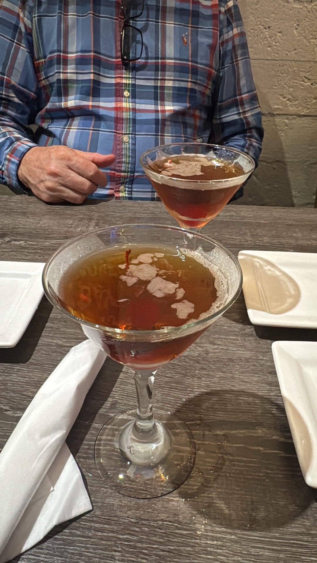
Catalina: Entering the United States is uneventful if you use the CBP Roam application, so we make it eventful on purpose as sometimes you have to make a mental transition. From there, we motored overnight in the typical Southern California calm to Avalon Harbor and stayed another few days. We have some very good friends who have a vacation cottage in Avalon and they were able to join us for a few days. This friend introduced me to the joys of “Manhattan” beverages and I am not so embarrassed to say we indulged…. At one point having lunch at an outdoor venue, an aggressive seagull stole my Wife’s tartar sauce cup from her plate of fish and chips – we tried to get that back for hours! After much negotiation with the bird, and many beverages, my Wife got the cup back and all was well…..
That evening the Avalon Casino was supposed to be showing Casablanca, which would have been wonderful, but my “good friend” got the dates mixed up and we were forced to watch a Disney Movie instead – my patience with my friend was tested. While we were invited to stay in their guest room, we took the very good water taxi service back to the boat and departed the next morning (disappointed the movie was not Casablanca as promised)….
The very smart bird well skilled in stealing food.
A couple of the many Manhattans enjoyed on Avalon….
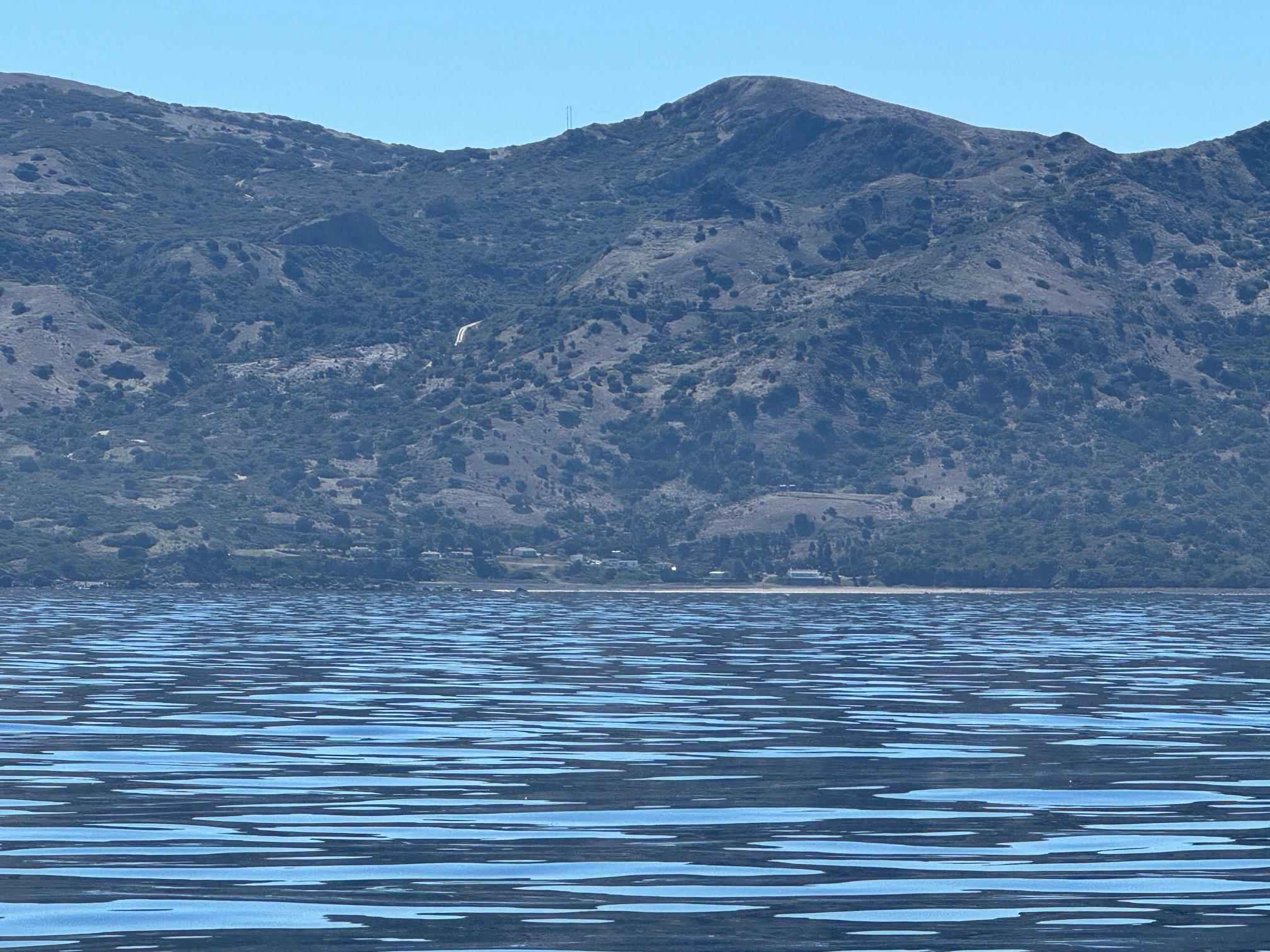
Catalina Island north of Avalon as we were departing – there are several private resorts on the eastern shoreline.
Point Conception / Cojo Anchorage: While Southern California up to this point is normally calm and flat, rounding Point Conception is not for the faint of heart – make sure the weather forecast is calling for a minimum of 12 hours weather acceptable to you and your crew before rounding it. At this point we were anxious to get home and after navigating through the offshore oil platforms, we got as close to the point as possible in the Cojo Anchorage. There are 3 mooring balls here reserved for Coast Guard vessels to also wait out for a calm passage – this anchorage offers good holding but is very rolly and uncomfortable in high seas – you get all of the wind. On the positive side, this is one of the best surfing spots in Southern California and you see people come out along the beach in anything from Motorcycles, to Jet Skis, to fancy boats to get as close to the point as possible and surf. Beware of dark spots on the surface as these indicate kelp so stay alert and avoid those – do not enter at night as you risk getting tangled in kelp. We stayed here for two days with one of our buddy boats (Folie a Deux) but did not gather face-to-face as it was still too rough for a dingy launch…. On the good side, the surfers, Amtrak Trains, and even SpaceX and Space Force launches will keep you entertained.
Long story short: I recommend anchoring here only if the weather is expected to calm soon – you won’t sleep well in strong winds and heavy surf.
Speaking of buddy boats, at this time our other buddy-boat, Dolce Vita, was still experiencing some mechanical issues and while back aboard with spare parts, had still not started toward Ensenada.
We departed the Cojo Anchorage at noon just a few hours before the weather was predicted to calm – we put up with 14 foot seas and a 20 knot headwind for several hours – by the time we reached Morrow Bay, which is the next safe stop on the journey to SF Bay, we felt well rested and the weather looked really calm, so we kept going.
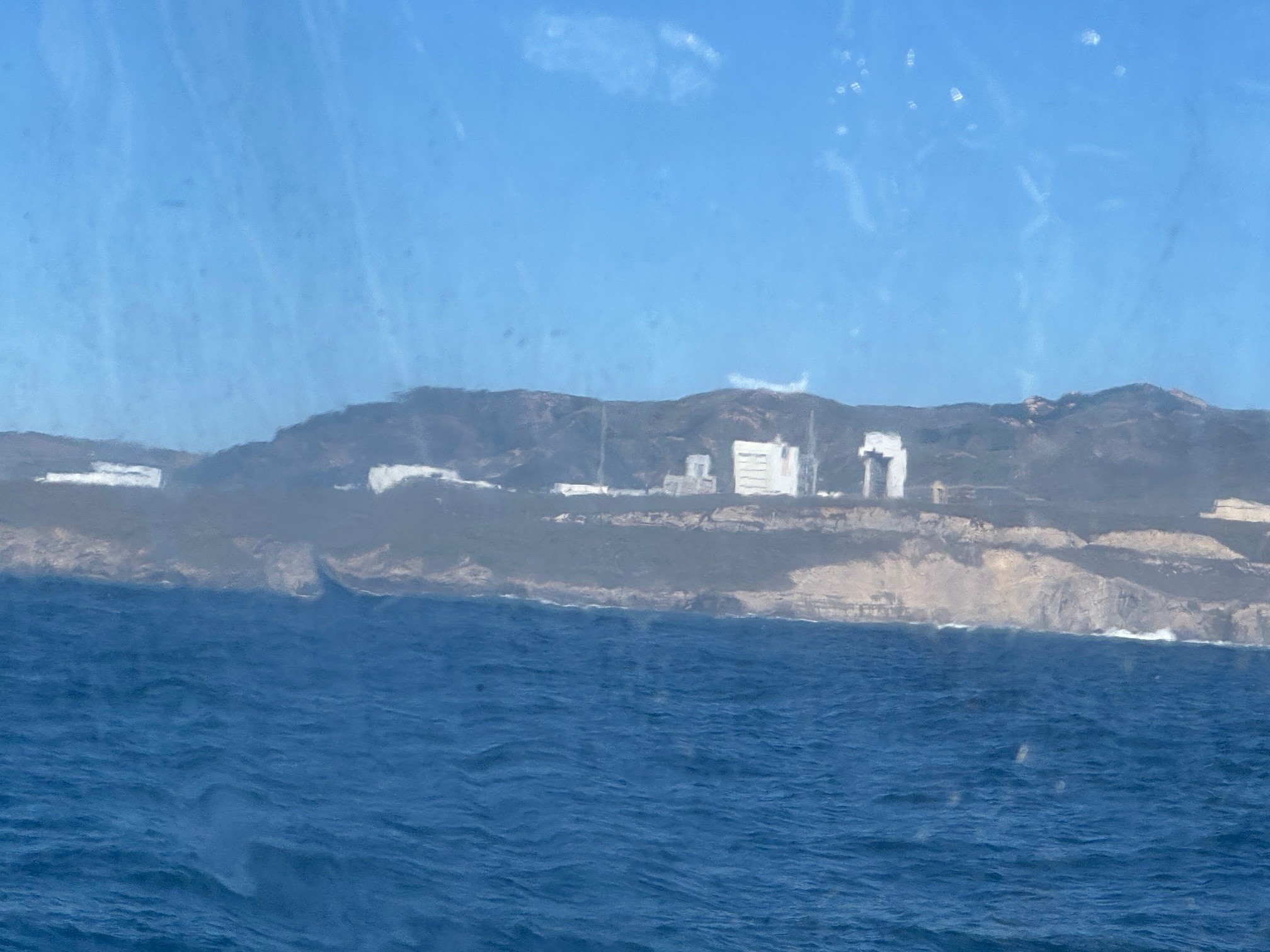
Photo of the SpaceX launch complex at Vandenberg Space Base
Morrow Bay to San Simeon Point and Monterrey: I note these three stopping points because my own standard is having a full 48 hours of favorable weather between Morrow Bay and Monterrey as there is no place to hide should the weather get rough. San Simeon is the only option in an emergency, but it is small and can accommodate only about 3 boats. In our case the weather remained favorable, we felt good, and opted to continue on nonstop.
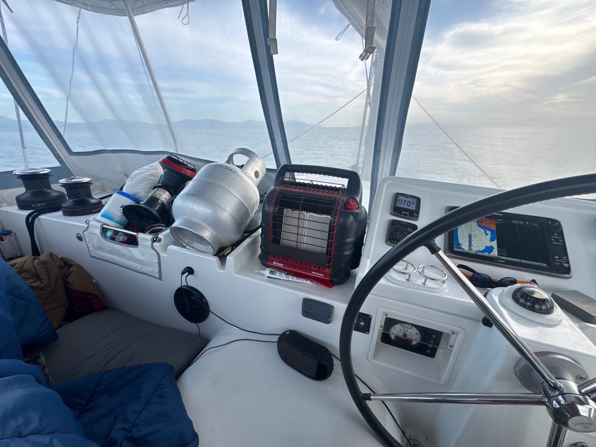
When Emerald Sea is light handed with only two crew members, the on-watch crew is allowed to rest in the cockpit next to the helm – we take advantage of the long bench seat.
If you look at any chart, the area between Morrow Bay and Monterey Bay offers no shelter at all, so I insist on 48 hours of a favorable weather forecast before I transit. I have once had a following wind and it offered the rare pleasure of sailing north, but in most cases the prevailing wind is north-to-south, so just make sure you have taken on enough fuel to motor through it. Emerald Sea does not perform well head to wind and as a sailor her Captain does not like burning diesel, but you gotta do what you gotta do to get home. In this area I like to stay 20 to 40 miles offshore – you miss the scenic nature of Big Sur, but you avoid overnight fishing boats, floating fishing apparatus, and huge globs of kelp that seem to be more frequent as we progress north.
As we approached Monterrey 30 some hours later, we still felt good, we saw heavy weather forecasted in a couple of days, so we still continued on knowing we could stop if needed in Half Moon Bay.
We continued on. Overnight between Monterrey and Half Moon Bay we found ourselves directly in the path of a very bright pale-yellow’ish light with no navigation lights. It appeared on radar but was not broadcasting AIS. My Wife correctly woke me and after radioing the object several times to no response, we gave way to starboard to get around it – we have no idea what it was (fishing vessels will often have bright lights on their deck so they can see their apparatus at night, but this object had no observable navigation lights at all.
Only 3 times in this six month period did we encounter vessels that did not give way:
1. Once while in the Baja HaHa fleet at night while I was on watch, I observed a vessel on AIS and then visually on a direct collision course with Emerald Sea. That Skipper had accidentally (probably half asleep) hit a button in their autopilot and turned completely in the opposite direction! After giving way appropriately and negotiating on the radio, his course was corrected and they continued on normally.
2. South of Ensenada, again at night, a Fishing Vessel (not fishing at the time) out of Sitka Alaska (according to their AIS information) with proper and observable navigation lights and AIS was observed on a direct collision course while Becky was on watch. She woke me and we called on the radio several times – that crew was either asleep or fully committed to fishing, but they did not respond to radio calls in English (for a while, I thought perhaps this was a vessel recently purchased by a Mexican National and maybe they did not change the AIS transponder – we were never sure). We gave way to avoid collision.
3. As noted earlier this mysterious yellowish very bright lights was directly in our path. It was very late at night but we feel as if the object made maneuvers to get in our way – we veered dramatically to starboard, and then more, and then dramatically more to get out of it’s way. It was very odd and we passed very/uncomfortably close by – it was too dark and the light was too bright to see any shape or profile – it was a very strange encounter….
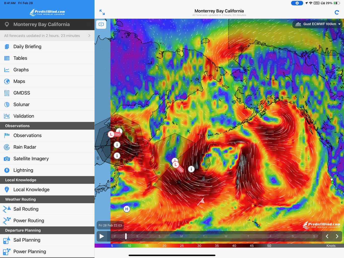
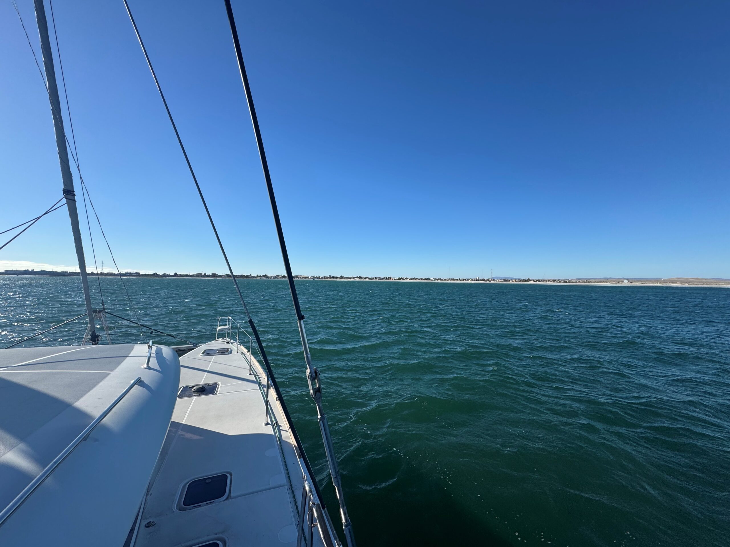
Monterey Again at Monterey, the forecast showed a strong storm coming in and the weather was good, we felt good having fallen into a comfortable rhythm of sleep, watch, helm, so we continued directly to San Francisco Bay. The weather built for our entry on February 28, 2025 but after the turn into the shipping channel it gave us a nice beam reach (in addition to a flood tide) and we were able to properly sail from the outer marker and through the channel.
Home.
When you are used to 80 degree temperatures in Mexico and come home in February, the helm needs to be equipped with a propane heater (or two) and very warm sleeping bags. It’s darn cold up here!
The February 28, 2025 Weather forecast – if we did not make it home on this day, we would have to wait another week In Monterrey for the expected storms to pass.
Thank you for reading this rather verbose blog, but I can not over emphasize the mixed emotions you experience after having been gone for several months and finally arrive home. Our Golden Gate Bridge represents so much; beginnings, endings, home, comfort, and renewal. The sense of accomplishment sets in first, and as I write this memory the anticipation of going to do it again is growing. As I tell my students: Sailing is a different sport. To many it is a comfortable day sail in familiar waters. To others it gets under your skin…. In your blood…. It owns you…. You can’t wait to do it again! Sailing is a virus for which there is no cure, so be careful. Don’t take my class because some of my students (who I know are reading this) have caught it (you know who you are)….
As a final note I am pleased to report that our 3rd buddy boat, Dolce Vita, after suffering mechanical issues and delayed by storms while bashing north, arrived in the Bay Area just a few days ago. There will soon be a reunion of (at least) the skippers of Dolce Vita, Folie a Deux, and Emerald Sea, and you can safely bet we will be discussing our next sailing adventures.
There are only a couple of opportunities to take the TWSC Sailing Catamaran Class left! The Lagoon 450F is the most popular sailing Catamaran in the world, and you are sure to encounter this model in your family chartering! Register while there is opportunity.
And we will see you out there!
Jeff and Becky Hare Sailing Vessel Emerald Sea Tradewinds Sailing School and Club Instructor
By Jeff Hare, Tradewinds Instructor and owner of Emerald Sea
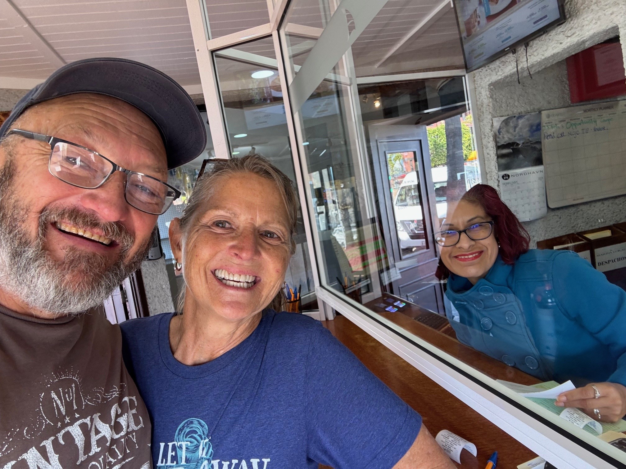
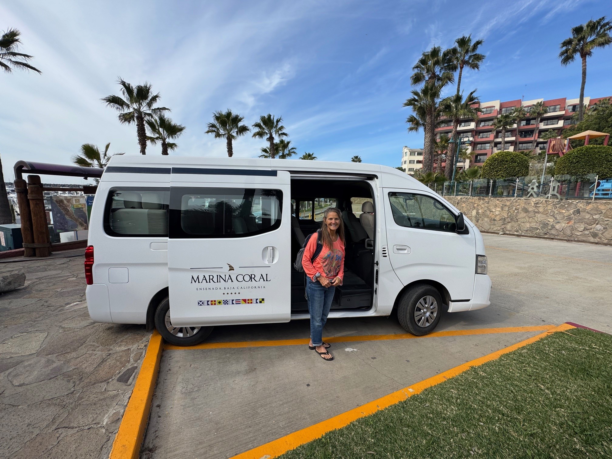
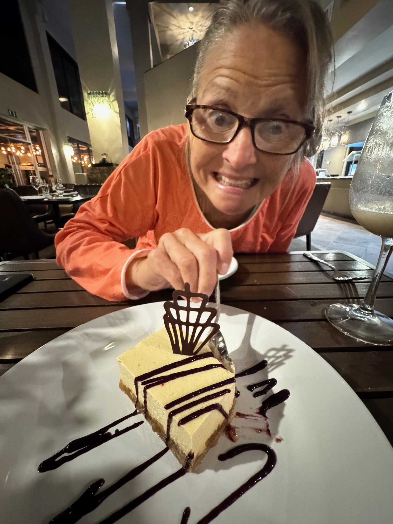
Reaching Ensenada is a big milestone when bashing home – a lot of sailors rush past this wonderful location all in a rush to get home. We are the opposite – we like to stay a few days and mentally prepare for the faster pace of the USA. Our Buddy Boat stopped at the public marina and quickly checked in and out. Becky and I enjoy spending a few days at Marina Coral enjoying the hotel amenities. We have been cold since leaving Cabo San Lucas, so a few hours soaking in the hot tub was welcome, although it feels somewhat artificial when compared to the pristine waters of the Sea of Cortez. We explored the city, ate the last of our Mexican fresh foods (you can not take any fresh fruits, veggies, or proteins back to the USA) mixed with visits to finer restaurants. Marina Coral is not inexpensive, but the staff here is first-rate. Included in your marina rate is a chauffeured drive to Customs to “check out” of Mexico. Once you do, you are required to vacate the country within 48 hours.
When we entered the country several months ago it was with the Baja HaHa fleet with nearly 300 people. We did not notice that our passports were not stamped. We had all of the other necessary documentation that supported our entry, just not the stamp. After paying a small fine and the entry fee again, we officially checked in and out the same day (none of the other marinas we visited, where you must show passports, noticed the stamp was missing). Everything fixed with the help of Fabiola (marina manager at Marina Coral) and her staff as they aided in the negotiation with Mexican Customs, we grudgingly departed Ensenada and Mexico for the (approximately) 65 mile motor to the Customs Dock in San Diego. This trip was somber and uneventful – a milestone marking the end of our 5 months in Mexico.
We arrived in San Diego with all the realities mayhem and business of the port of San Diego. The week before we arrived a military aircraft had lost engine power and crashed right into the channel leading to the customs dock – I thought they would have removed it, but apparently they were using it as a training opportunity and let the Navy Seals perform mock recovery missions on the wreck – they seemed in no hurry to remove it and the entire channel was blocked with the barge and crane that would eventually lift the remains of the jet. After chatting with the guard and checking to make sure it was high-tide, we motored past the channel about 1/4 mile and cut directly into the sea wall, turning left again and following it closely back into the channel behind the barge – if you check a local chart you can get a pretty accurate view of this back-channel and the depth it provides. We arrived at our reserved slip and stayed there another three days. During that time US Customs performed their inspection and we checked back in to the good old US of A!!!
Keeping track of our two other buddy boats at this time; Folie a Deux had passed through San Diego and stopped in Santa Barbara for a few days as that owner had a wedding to attend. Dolce Vita was still anchored in Punta Baja being watched by some local fisherman while her owner and crew traveled home to consult with some local mechanics regarding her ability to motor the remaining distance.
By Jeff Hare, Tradewinds Instructor and owner of Emerald Sea
Bahia Tortuga / Turtle Bay is a planned stopping place for nearly every brasher for many reasons. First of all, it represents half-way home (at least to San Diego from Cabo). They have restaurants, fuel, and a couple of good grocery stores. The biggest reason to stop is that they are a fully enclosed bay with full protection from weather coming from any direction. You can sleep in the bay to rest and recover for as long as you wish.
Also while here, SpaceX was nice enough to launch some Starlink Satellites and we took a rather spectacular video of the launch and direct flyover of this bay.
Our buddy boats, Folie A Deux and Dolce Vita had arrived a few days before us. Both having professional crew, Dolce Vita took off early as they had some timelines to meet. Unfortunately they met with some mechanical issues and parked their boat in Punta San Carlos for a couple of weeks while the crew returned to their homes and the owner was able to get back to the United States for Parts. (Today February 25, the owner is back aboard with a crew member and parts with plans to depart tomorrow).
Emerald Sea and Folie a Deux left as a pair on February 12 while the weather was still harsh. With big waves and a very strong headwind we motored at the fullest speed possible to the lee side of Isla Cedros and spent the next few hours continuing slowly as the winds died down. On the Eastern Side of Cedros the winds were still strong so we sailed as close-hauled as we could as far northeast as possible. The winds died down to their predicted 10 knots and we sailed on to a bay called Punta Colonett with a total distance traveled of 204 miles from Bahia Tortuga.
Bahia Colonett is just south of Ensenada and a good place to stop if you are coming in to Ensenada a little earlier than your slip reservation. We stayed their one night and continued to Marina Coral for a few days of Hot Tub soaking and restaurant food.
By Jeff Hare, Tradewinds Instructor and owner of Emerald Sea
Tuesday February 4 at Noon.
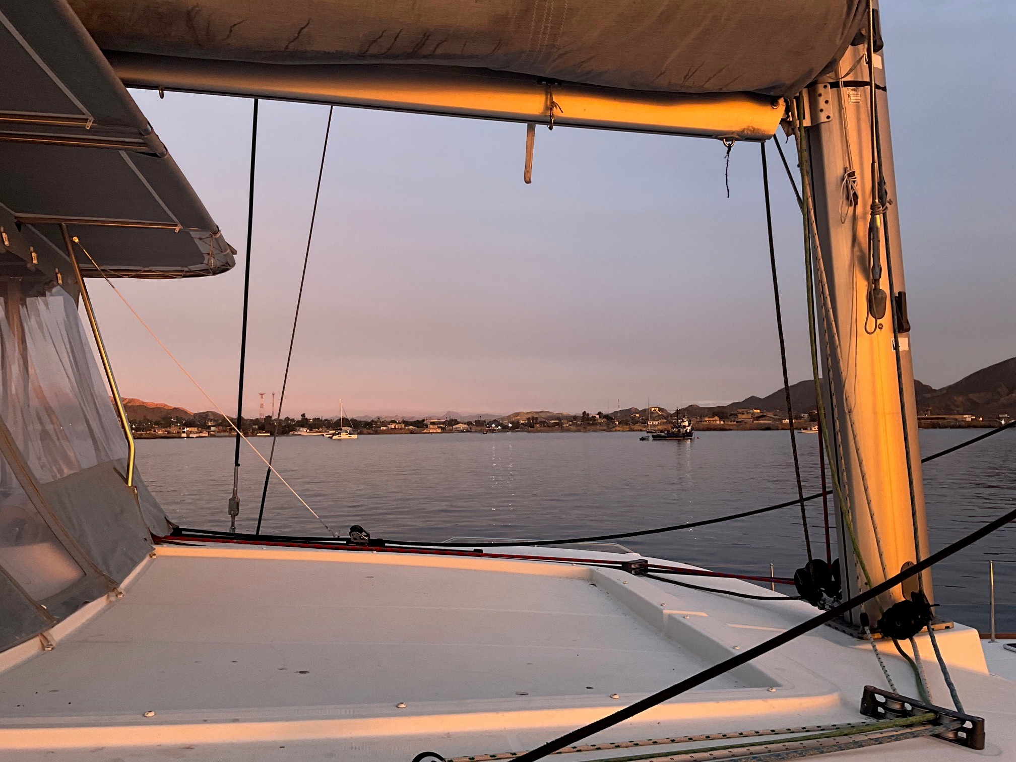
Emerald Sea has just arrived at the little town of Punta Abreojos as I write this – the anchor and anchor alarm is set and I like to sit up for at least an hour to watch it before falling asleep for a well deserved rest – writing to you is occupying a little of that time. With just the two of us, we sailed nonstop from Puerto Vallarta (Marina LaCruz) across the Sea of Cortez to Cabo San Lucas, waited there for a few days as all 3 of our buddy boats gathered, and now sailed up the Pacific Coast of the Baja Peninsula to this town, another 314 miles nonstop over 74 hours. We are a little sleepy, so who knows what I might write in my barely conscious state…..???
We are joined by boats Dolce Vita and Folie a Deux who all intend to remain in our little fleet all the way to San Francisco Bay. Both of these other boats have flown their Significant Others back home and brought in experienced delivery crew – only Emerald Sea has just the two of us novices. So far, so good – we only have another 400 miles to Ensenada, 450 to San Diego, and about a thousand to San Francisco. Not overwhelming at all!
This being our 2nd year spending several winter months cruising Mexico, we enjoy it immensely! The Mexican people are honestly interested in getting to know you. The Xpats, both Canadians and Americans who live here seasonally or full time are always ready to give advice, help in any way, translate, or advise. The anchorage areas offer uncrowded bliss, remote vistas, and crystal emerald water. When you need a marina or boat work, these are also top-notch. We had Emerald Sea’s exterior detail-cleaned and she has never been so spotless (Thanks Aaron and team)!! Of course with a few hundred miles and offshore hours, she needs to be cleaned again…. Maybe after my nap.
I am very pleased that just the two of us seem to have been able to handle these longer distance segments. We impose shifts of 4 hours with the off-shift crew person staying right in the cockpit and acting as Watch.
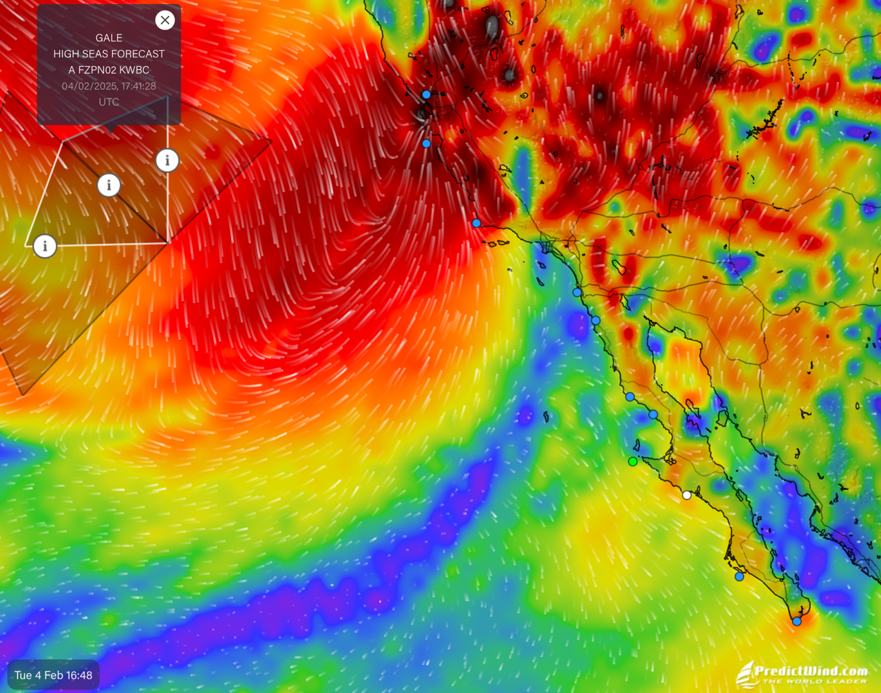
Our little fleet will be anchored here for a few days as the rain you are all getting in California now, will bring high surf and eventually high winds here also – we will try to move the 100 miles north to Bahia Tortuga, but may also be stuck here up to a week while the storm eventually passes. I’ll update you one way or another. We will need a 3 day stretch of calm to cross the Bahia Sebastian Visciano to the north. (The white dot is our current location, the green dot is near Bahia Tortuga, the blue dots are other important weather locations I keep handy and all the red stuff is very bad for sailboats and sailors)…..
If you get your hands on a copy of the February issue of Latitude 38, please see our early cruise summary inside the Bahia de California (the Sea of Cortez) – we hope to spend an entire season there soon.
Also make sure to check the schedule for Cruising Catamaran on the Tradewinds Calendar. Time is running out, as Emerald Sea will soon be cruising more distant waters…..